PLANNING AND ENVIRONMENTAL LINKAGES FOR HISTORIC PRESERVATION
June 1, 2012

Prepared for:
Federal Highway Administration
Office of Project Development and Environmental Review
Federal Highway Administration (FHWA)
U.S. Department of Transportation
|
Prepared by
Cambridge Systematics, Inc.
and SRI Foundation
|
ACKNOWLEDGMENTS
Cambridge Systematics, Inc. and the SRI Foundation wish to acknowledge Ms. Mary Frye and Ms. MaryAnn Naber of the Federal Highway Administration, who supervised this project and provided valuable guidance in the selection and development of the case studies included in this report. The principal authors of this report, Mr David Cushman and Mr. Terry Klein of the SRI Foundation, wish to thank the following individuals who provided information on their respective transportation agency programs. This project would not have been possible without their generous assistance: Dr. Ruth Greenspan, Arizona Department of Transportation; Dr. Anmarie Medin, California Department of Transportation; Ms. Michelle Meaux; Capital Area Metropolitan Planning Organization of Central Texas; Mr. F. Yates Opperman and Ms. Lisa Schoch, Colorado Department of Transportation; Mr. Peter McGilvray, Florida Department of Transportation; Ms. Mary Kennedy, Indiana Department of Transportation; Dr. Elizabeth Hobbs, Minnesota Department of Transportation; Mr. Ron Shutiva, New Mexico Department of Transportation; Dr. Matt Wilkerson, North Carolina Department of Transportation; Dr. Jeani Borchert, North Dakota Department of Transportation; Ms. Susan Gasbarro, Ohio Department of Transportation; Dr. Ira Beckerman, Pennsylvania Department of Transportation and Ms. Jennifer Horn, Preservation Pennsylvania; Dr. Anthony Opperman, Virginia Department of Transportation; and Mr. Scott Newman and Dr. Jeannie Russell, Vermont Agency of Transportation. The principal authors would also like to thank the staff of Cambridge Systematics, Inc., who managed the production of this report: Ms. Elizabeth Sanford, Ms. Joanna Hite, and Ms. Angela Valenti.
CONTENTS
INTRODUCTION
The Federal Highway Administration (FHWA) and state and local transportation agencies are working hard to deliver projects more quickly and efficiently, and for less cost. Many state departments of transportation (DOT) and local transportation planning organizations have developed innovative programs to help them achieve these goals. Several of these programs focus on streamlining compliance with Section 106 of the National Historic Preservation Act and improving historic resource stewardship, through the early consideration of historic preservation factors in planning and early project development. These programs are consistent with the Federal Highway Administration's (FHWA) Every Day Counts initiative to identify and implement innovative practices that expedite project delivery, enhance roadway safety, and protect the environment. An important element of the Every Day Counts initiative is FHWA's Planning and Environment Linkages (PEL) program. PEL encourages the use of information developed in transportation system planning to inform the National Environmental Protection Act (NEPA) review process. PEL also is consistent with the regulations implementing Section 106 of the National Historic Preservation Act (i.e., 36 CFR Part 800).
This report was prepared in support of the FHWA Every Day Counts initiative. Presented are case studies showcasing effective state DOT and local transportation agency programs that consider historic preservation factors in planning and early project development. The achievements of these agencies and the lessons they have learned can serve as guidance for other agencies who may be thinking about developing and implementing similar programs. The majority of the case studies included in this report were originally showcased in a 2009 National Cooperative Highway Research Program (NCHRP) report entitled NCHRP Project 25 25, Task 49, Effective Practices for Considering Historic Preservation in Transportation Planning and Early Project Development. The current report updates the results of the NCHRP Task 49 study and provides analysis on the effectiveness and benefits of these programs.
Table 1 lists the 17 case studies included in this report. The case studies are organized by program type. These types include, for example, Section 106 programmatic agreements (PA), historic property databases for State DOT rights-of-way, statewide management of historic bridges, and staff liaison programs with State Historic Preservation Offices (SHPO). Table 1 also highlights the key elements associated with each of the case studies.
A discussion on the methods used to prepare these case studies can be found in Appendix A. This appendix also includes an analysis of the commonalities found in the case studies.
Table 1. Case Study Program Types and Key Elements
| CASE STUDIES |
PROGRAM ELEMENTS |
| Transportation Planning |
Early Project Development |
Interagency Cooperation |
GIS |
Databases |
Screening Tools |
“Red Flags” |
Archaeo-
logical Sensitivity |
Program-
matic Approaches |
Tribal Consultation |
Stream-
lined Decision-Making |
| Programmatic Agreements (PA) |
| Colorado DOT, I-70 Mountain Corridor Tiered Environmental Impact Statement |
X |
X |
|
|
|
|
|
|
X |
|
X |
| North Dakota DOT Tribal Consultation |
X |
X |
|
|
|
|
|
|
X |
X |
|
| Vermont Transportation Agency Section 106 Delegation PA |
|
X |
|
|
|
|
|
|
X |
|
X |
| Staff Liaison Programs |
| California DOT |
|
X |
X |
|
|
|
|
|
|
|
|
| Ohio DOT |
|
X |
X |
|
|
|
|
|
|
|
|
| New Mexico DOT |
X |
|
X |
|
|
|
|
|
|
X |
|
| Archaeological Predictive Modeling |
| Minnesota DOT |
|
X |
|
X |
X |
|
|
X |
|
|
|
| North Carolina DOT |
|
X |
|
X |
X |
|
|
X |
|
|
|
| Historic Bridges Management Program |
| Indiana DOT |
X |
X |
X |
X |
X |
|
|
|
X |
|
|
| Ohio DOT |
X |
X |
|
X |
X |
|
|
|
|
|
|
| Rights-of-Way Databases/Portals |
| Arizona DOT |
|
X |
|
X |
X |
|
X |
|
|
|
|
| California DOT |
X |
X |
|
X |
X |
|
X |
|
|
|
|
| Internal Project Development Database |
| Virginia DOT - CEDAR |
|
X |
|
X |
X |
X |
X |
|
|
|
|
| On-Line Section 106 Consulting Parties Identification and Communication Tool |
| Pennsylvania DOT and Project PATH |
|
X |
X |
|
|
|
|
|
|
|
|
| Digital Screening Tool and Decision-Making Process |
| Colorado DOT - PEL Program |
X |
X |
X |
X |
X |
X |
X |
|
|
|
X |
| Florida DOT - ETDM |
X |
X |
X |
X |
X |
X |
X |
|
|
X |
X |
| Local Government Databases and Transportation Planning Tools |
| Texas - Capitol Area Metropolitan Planning Organization |
X |
|
X |
X |
X |
X |
X |
|
|
|
|
Back to Top
PROGRAMMATIC AGREEMENTS
Colorado Department of Transportation
June 1, 2012
Program Elements
- Historic Preservation in Transportation Planning
- Historic Preservation in Early Project Development
- Programmatic Approaches to Identifying, Evaluating, and Managing Historic Properties
- Decision-Making Process for Streamlining
Program Benefits
- FHWA and Colorado DOT prepared a comprehensive programmatic agreement (PA) to fulfill their Section 106 responsibilities for a Tier 1 EIS and all future Tier 2 projects.
- The PA establishes an agreed-upon process for future decisions on National Register eligibility, effects, and resolution of adverse effects, providing predictability in the Section 106 process for all future Tier 2 projects.
- As stipulated in the PA, Colorado DOT prepared a historic context after completion of Tier 1. The historic context provides CDOT information on the potential for significant historic properties within areas associated with all Tier 2 projects, bringing predictability to compliance requirements for these future projects.
Program Description
Colorado DOT (CDOT) developed a tiered environmental impact statement (EIS) for the proposed I-70 Mountain Corridor project. This project involves improvements to I-70 from Glenwood Springs to C-470, west of Denver. A programmatic agreement (PA) was executed during preparation of the Tier 1 EIS, stipulating the process for complying with Section 106 requirements for all Tier 2 undertakings. Signatories to the PA included the Federal Highway Administration (FHWA), CDOT, the Colorado State Historic Office (SHPO), the Advisory Council on Historic Preservation, the Bureau of Land Management, and the U.S. Forest Service. Many local communities and historical societies signed as concurring parties.
The PA anticipates direct, indirect, and cumulative effects to historic properties, including the Georgetown-Silver Plume National Historic Landmark, from Tier 2 projects, and establishes a process for addressing these effects in consultation with the consulting parties and project stakeholders. Pursuant to the PA, CDOT prepared a historic context for evaluating which properties within the I-70 Mountain corridors are eligible for listing in the National Register of Historic Places. CDOT also will develop historic preservation-related design guidelines for Tier 2 undertakings. CDOT also will assist local governments to preserve the historic character of their communities within the project corridor.
Setting Up the Program
- During the initial Tier 1 process in 2005, there was confusion among the agencies and stakeholders on the compliance requirements for the National Environmental Policy Act (NEPA) versus Section 106 of the National Historic Preservation Act, especially in terms of the potential indirect effects on historic properties that might occur during the advancement of Tier 2 projects. These Tier 2 projects would have few direct effects on historic properties; however, there was stakeholder concern about indirect effects, particularly noise impacts. This confusion among the parties about the NEPA process versus the Section 106 process was, in part, a result of the lack of guidance and experience with how to carry out Section 106 compliance in the context of a tiered EIS.
- CDOT, through its environmental contractor for the Tier 1 project, hired a Section 106 professional to help sort out these issues, and to work with the consulting parties to develop an agreement document that would complete the Section 106 process for Tier 1 and establish a compliance process for Tier 2 undertakings.
Challenges Encountered
- The biggest challenge in developing the I-70 PA involved clarifying for the consulting parties the differences between NEPA and Section 106 requirements. Persistent communication and education through multiple meetings, conference calls, and e mails were required to overcome this challenge. Once the parties understood the issues germane to specific Federal mandates, productive consultation followed, resulting in the PA.
Program Maintenance
- There have been no amendments to the I-70 PA; however, CDOT did decide to complete the historic context as a Multiple Property Documentation Form (MPDF), which is a rigorous tool for evaluating the National Register eligibility of properties. CDOT believes the MPDF will provide consistent guidance in property evaluations for the Tier 2 undertakings and also will provide the framework for nominating properties to the National Register.
- There have been no notable challenges or issues with implementation of the PA. The first of the Tier 2 undertakings - the Twin Tunnels Environmental Assessment (EA) - is underway. The Twin Tunnels EA project is CDOT's first opportunity to road test the PA.
Critical Factors for a Successful Program
- Based on CDOT's experience to date with the Twin Tunnels EA, early and comprehensive consultation with the SHPO and the other consulting parties is critical. The PA outlines the overall process for how to conduct Section 106 for Tier 2 undertakings, which generally follows the steps outlined in 36 CFR 800. The PA, however, also includes more detailed stipulations for consultation at the project scoping level, and for all subsequent steps in the process, from development of an area of potential effect to resolving adverse effects.
- Due to the extended timeframe for Tier 2 project development and construction along the I-70 corridor, it will be important to provide a consistent approach to implementation of the Section 106 process outlined in the PA. Over time, as staff and consulting party contacts change, there may be challenges to maintaining the consistency set forth by individuals who were involved in the development of the PA and in the initial implementation of the agreement.
For more information: Lisa.Schoch@dot.state.co.us
Back to Top

PROGRAMMATIC AGREEMENTS
North Dakota Department of Transportation
June 1, 2012
Program Elements
- Historic Preservation in Transportation Planning
- Historic Preservation in Early Project Development
- Programmatic Approaches to Identifying, Evaluating, and Managing Historic Properties
- Process for Tribal Consultation
Program Benefits
- The State's programmatic agreement (PA) provides a single set of procedures for Tribal consultation. The PA also creates a process for discussing and resolving problems. From the Tribes' perspective, their views are now being heard and respected by the agencies.
- The PA fosters inter-Tribal relationships regarding historic preservation issues affecting properties on the Northern Plains, and allows NDDOT to address these properties as a group, as opposed to on a site-by-site basis.
- The PA avoids areas of conflict which can delay subsequent projects, resulting in more realistic project schedules and budgets.
Program Description
Initially, the Federal Highway Administration (FHWA) and the North Dakota Department of Transportation (NDDOT) consulted with Federally recognized Tribes with historic ties to territory within the State on a project-by-project basis. The goal of this consultation was to balance transportation needs with Tribal concerns about places of religious and cultural significance. Through these consultation efforts, the agencies established working relationships with individual Tribes based on mutual respect. In 2004, NDDOT met with the Tribes to discuss ways of improving the Department's Tribal consultation efforts. NDDOT asked the Tribes if they would be interested in entering into a Programmatic Agreement (PA) and was prepared to write agreement documents for each Tribe. The Tribes, however, said they wanted a single consensus document that was negotiated concurrently with all parties. Multiple meetings were held between NDDOT and the Tribes to draft the PA, during which NDDOT continued to consult with the Tribes on a project-by-project basis. The PA took two years to develop and was signed in 2006. The idea of developing a consensus PA received a high level of support from upper management within NDDOT, which was open to the idea of maintaining positive relationships with the Tribes.
Setting Up the Program
- One staff member within NDDOT was designated the point person for developing the PA. State funds were used to prepare the PA, which included hiring a consultant to assist in drafting the PA, and to manage the Tribal representatives' travel costs to attend meetings to work on the PA. NDDOT's point person currently fills the position of the Department's Tribal Consultation Specialist.
- Under the PA, NDDOT has authority to speak with the Tribes on behalf of the FHWA, although the FHWA retains government-to-government consultation responsibilities. The DOT handles all day-to-day consultation.
Challenges Encountered
- The duties of the Tribal Liaison were assigned to the NDDOT staff member who already was engaged in Tribal consultation so funding the position was not an issue. Additional funding was needed to pay for the annual meetings hosted by NDDOT but upper management supported this expenditure. There were some problems initially with paying for food and securing rental space needed for the meetings at State rates, but otherwise funding has not been a problem.
Program Maintenance
- NDDOT's Cultural Resource Section continues to work with regional Tribes (currently 14 Tribes and bands) under the 2006 PA. As part of the agreement, NDDOT hosts two meetings a year where all parties meet to discuss the State Transportation Improvement Plan (STIP), upcoming NDDOT projects, previous projects, and related issues. Tribal consultation begins in planning and continues forward into project development.
- The program is relatively inexpensive when compared with the overall level of Federal funding coming into the State. NDDOT spends approximately $100,000 a year to host Tribal meetings and typically another $50,000 on specific project Tribal involvement efforts.
- The Tribes continue to enthusiastically participate in NDDOT's Tribal meetings, which continue to grow both in size and spirit.
- There has been no change in the State funding for the Tribal Involvement Program nor have there been any difficulties in maintaining the program. The program has the commitment of upper management, which sees the benefits of fostering a good relationship with Tribes and assisting FHWA in their compliance needs.
- The NDDOT Tribal consultation PA continues to have great support from FHWA, NDDOT, and the Tribes.
Critical Factors for a Successful Program
- A critical factor in the success of the Tribal Involvement Program is the support of NDDOT management. NDDOT management had to have the will, the vision, and the spirit of true partnership needed to see the world through someone else's perspective.
- The foundation of this program was forged by FHWA, NDDOT, and the Tribes working together to create a process that would work for all the parties, which was then codified into the PA. The PA was created by sitting at the table together and discussing the issues.
For more information: http://www.dot.nd.gov/divisions/environmental/docs/programmatic-agreement-tribal-consultation.pdf
Back to Top
PROGRAMMATIC AGREEMENTS
Vermont Agency of Transportation
June 1, 2012
Program Elements
- Streamlined Decision-Making Process
- Programmatic Approaches to Identifying, Evaluating, and Managing Historic Properties
- Historic Preservation in Early Project Development
Program Benefits
- VTrans' historic preservation staff processes 300 to 400 projects each year. This is possible as a result of the PA and the manual for implementing the PA.
- The amount of Section 106 compliance review documentation has been cut in half as a result of the PA.
- The time required for Section 106 reviews was reduced by around 30 percent.
- The level of protection for historic properties has been better than anticipated, since consideration of possible effects to historic properties occurs early in the project development process. The latter is possible since the individuals dealing with historic preservation issues and making decisions about Section 106 compliance are within VTrans.
Program Description
In 1997, the Vermont Agency of Transportation (VTrans), the Vermont State Historic Preservation Office (SHPO), and the Federal Highway Administration (FHWA) began discussing how to improve the Section 106 process for transportation projects in the State. These discussions focused on how to make the process easier, faster, more effective, and less redundant while maintaining an appropriate level of pro-tection for historic properties. The result of these discussions was a comprehensive delegation programmatic agreement (PA) among the parties, signed on April 5, 2000.
Under the PA, VTrans conducts reviews of Federal-aid highway projects, using qualified historic preservation professionals on VTrans staff. These reviews require no consultation or input from the Vermont SHPO or FHWA, except in rare instances. This internal review involves identification of historic and archaeological resources within a project's area of potential effect, National Register evaluation, determination as to whether or not a project will have an adverse of effect on National Register properties, and resolution of any adverse effects on these properties through the use of a standardized set of treatment measures. The PA also guides the development of tools to improve the compliance process, such as resource databases and Geographic Information System (GIS)-based archaeological predictive modeling. A standards and guidelines manual was prepared, setting out the process for implementing the PA.
The primary objectives of the PA are to enhance early project planning so as to avoid or minimize impacts to historic properties, to conduct more timely and predictable Section 106 reviews, and to enhance public support for projects.
Setting Up the Program
- Development of the PA began in 1997 with the creation of a committee with representation from FHWA, VTrans, and the SHPO. There also was periodic consultation with the Advisory Council on Historic Preservation. The committee met for nine months on a bimonthly basis; and, these meetings often involved tough and intense negotiations. The PA text was drafted, revised, and drafted again, between these meetings. After the production of over 20 drafts, the PA was completed and signed in 2000.
- No special funding source was used to develop the PA. Development was part of VTrans' staff's normal duties, which included policy work and generating agreements to improve the efficiency and effectiveness of VTrans' Section 106 compliance program. VTrans staff worked on the PA four to five hours a week on average.
- The PA created two internal VTrans project review positions: a Historic Preservation Officer and an Archaeology Officer. These Officers have been delegated the SHPO's review authority and make all required Section 106 findings.
- The development of the standards and guidelines manual for implementing the PA took an additional two years. The manual included every possible scenario that may arise within the Section 106 review process, and provided detailed guidance on each component of the PA.
- Since the signing of the PA in 2000, there has been one amendment. VTrans is now conducting Section 106 reviews for the Federal Transit Administration in the same manner as VTrans conducts reviews for projects funded or approved by FHWA. This was accomplished with a one page amendment to the PA in 2003.
Challenges Encountered
- One challenge was the immense amount of work needed to develop the PA and manual. As noted above, over 20 drafts of the PA were produced, with each draft generated by a lead author from the SHPO and VTrans.
- The delegation of adverse effects findings to VTrans was an initial stumbling block to the development of the PA. VTrans, however, that this finding should be fully delegated to the department if VTrans was going to invest so much time and effort. Once the parties worked out the process for using standard treatment measures to resolve adverse effects, this component of the PA development went relatively smoothly.
- There was a hesitance within VTrans as to whether the program would really save time and money and streamline the compliance process? Assurances were required in order to keep the program development moving forward.
- There were some initial questions as to whether or not VTrans had the staff to take on this program. At the time of the program's development, VTrans had two archaeologists and two architectural historians/historians on staff.
Program Maintenance
- Maintaining the program has gone smoothly. All of the review efficiencies established through the PA have become standard operating procedures. Consultation and compliance decisions are accomplished within days or even hours.
- The program's annual reviews by the SHPO and the State's advisory council on the program (which was set up by the governor) have given the PA program high ratings. Attempts to achieve even greater efficiencies while maintaining program quality are a source of some tension.
- One of the program's biggest challenges is maintaining enough staff to handle the compliance work load. In addition to the two officers, the program has two temporary assistants. The program is working to change these two temporary positions to “limited service positions” in Fiscal Year 2013 (i.e., two-year full-time positions with benefits).
Critical Factors for a Successful Program
- The manual was critical for establishing a level of comfort and trust with the SHPO and other agencies involved.
- Continued support from the PA signatories.
- Having adequate staffing, starting from the development of the PA and continuing as the program moves forward.
- Recommend a minimum of two full-time employees, one for managing archaeological resources the other for the historic built environment.
- Take the time to fully consider all possible scenarios that may need to be covered by the PA.
- Successful development and implementation of this type of PA is based on mutual trust among all of the parties.
- The PA and associated programs should be built so they can “outlive” the staff involved in their creation.
For more information: Programmatic Agreement Manual of Standards and Guidelines
Back to Top

STATE HISTORIC PRESERVATION OFFICE LIAISON PROGRAM
California Department of Transportation
June 1, 2012
Program Elements
- Historic Preservation in Early Project Development
- Interagency Cooperation and Collaboration
Program Benefits
- The staff liaison program with the California State Historic Preservation Office (SHPO) provides California DOT (Caltrans) with fast SHPO project review turnarounds.
- SHPO staff working on Caltrans projects can participate in early project scoping
- The program has improved the working relationship between the SHPO and Caltrans.
- Other state and Federal agencies, local transportation agencies, and even private-sector companies that have to deal with Section 106 compliance see the benefits of Caltrans' liaison program, and want to participate by funding additional positions within the SHPO.
Program Description
In 2005, the California Department of Transportation (Caltrans) began funding review positions within the California Department of Parks and Recreation's (DPR) Office of Historic Preservation (i.e., the State Historic Preservation Office (SHPO)). Individuals filling these positions do not review Caltrans projects, but free up other SHPO staff to focus on Caltrans projects. This arrangement was formalized through an agreement between the agencies in February 2010. This staff liaison program allows the SHPO to fulfill its review responsibilities for transportation projects in a timely manner, and to partner with Caltrans and the Federal Highway Administration (FHWA) in developing and implementing measures to streamline the environmental review process.
The SHPO staff working on Caltrans projects provides technical assistance, coordination, and review services to Caltrans. The latter includes expedited Section 106 consultations; participation in early project scoping, planning, and development meetings; field reviews; project reviews; and other related activities. These services are provided on an “on-call” and “as available” basis. Caltrans currently funds three review positions within the SHPO.
Setting Up the Program
- The staff liaison program began in 2005 as an informal program, and was formalized in 2010. The formal agreement between the agencies establishes a scope of work for the program, and includes agreed upon performance objectives and a process for the SHPO's progress reporting to Caltrans. These performance measures include timeframes for SHPO staff reviews of Section 106 findings and decisions, such as the definition of Areas of Potential Effects, determinations of National Register eligibility, and findings of adverse effects. The performance measures are based on the procedural steps of the Section 106 process as defined in 36 CFR 800, and in the delegation programmatic agreement among the FHWA, Caltrans, SHPO, and the Advisory Council on Historic Preservation, signed in January 2004. The liaison program is monitored by the Section 106 Coordinator in Caltrans' Division of Environmental Analysis in Sacramento.
Challenges Encountered
- The primary challenges were logistical - obtaining funding for the program and explaining why the liaison program should be funded. These challenges were overcome by stressing the benefits of the program in terms of streamlining project delivery. These benefits were clearly demonstrated as the program moved forward.
- There was a concern that Caltrans funding of review positions within the SHPO would influence the objectivity of SHPO reviews of Caltrans' projects. Caltrans and DPR management were careful that such concerns were addressed through the structure of the program, i.e., in terms of the types of projects reviewed by the Caltrans-funded staff and who supervised these individuals.
Program Maintenance
- Caltrans and the SHPO have developed and refined communications protocols over time. The agencies also use video teleconferencing to involve the Caltrans districts. These video conferences are held quarterly.
- Funding for the liaison program comes out of the Department's capitol program - State highway trust account.
- Staff turn-over at the SHPO has been a challenge, often making it difficult to enforce the interagency agreement's scope of work. The SHPO is finding it hard to obtain staff for these review positions, which currently are two-year hires. The SHPO is trying to make them full-time.
- Other challenges are the current statewide hiring freeze and small size of the SHPO staff. The hiring freeze prevents the SHPO from meeting its overall staffing needs, which places a greater burden on the staff funded by Caltrans.
- If Caltrans' project workload continues to decrease, due to budget cuts, Caltrans may no longer need the services provided by the SHPO liaison program.
Critical Factors for a Successful Program
- Establishing good lines of communication among SHPO, Caltrans district staff, and the Caltrans Section 106 Coordinator in Sacramento.
For more information: anmarie_medin@dot.ca.gov
Back to Top

STATE HISTORIC PRESERVATION OFFICE LIAISON PROGRAM
Ohio Department of Transportation
June 1, 2012
Program Elements
- Historic Preservation in Early Project Development
- Interagency Cooperation and Collaboration
Program Benefits
- ODOT has also been able to reach “no adverse effect” findings based on the early consultation with the State Historic Preservation Office (SHPO) designated ODOT reviewers.
- As a result of this liaison program, the process of achieving concurrence on Section 106 findings has been streamlined.
- There is a positive working relationship between ODOT and SHPO, resulting from the liaison program.
Program Description
The Ohio Department of Transportation's (ODOT) revised Section 106 Programmatic Agreement, executed November 30, 2011, stipulates the funding of two positions at the Ohio State Historic Preservation Office (SHPO), to ensure the implementation of Section 106 in accordance with the agreement and to streamline the consultation process. This agreement builds upon two previous delegation agreements. The positions funded by ODOT (i.e., ODOT Transportation Review Managers) are dedicated to the review and processing of ODOT projects.
ODOT's funding of these positions has resulted in a collaborative Section 106 consultation process. Consultation includes informal and formal methods such as joint early project field scoping meetings with ODOT Cultural Resources (CR) staff, ODOT District Environmental staff, and the SHPO; in addition to informal meetings with CR team members and SHPO regarding survey methods, historic boundaries, National Register eligibility, identification of consulting parties, and measures to minimize harm to historic properties.
The SHPO's ODOT Transportation Review Managers recently assisted Federal Highway Administration (FHWA) and ODOT in the preparation of ODOT's updated Section 106 Training Class. ODOT district staff and ODOT's consultants attend this and other classes as a part of ODOT's professional certification program. The training team participates in a follow-up meeting after each training class to discuss ways to improve the next class. This approach has enhanced the working relationship between the agencies while recognizing their respective roles and responsibilities.
Setting Up the Program
ODOT first contracted for the review positions at the SHPO in 1998. At that time, ODOT had a large highway program with several rural four-lane gap closure projects around the State, so there was a large volume of projects requiring reviews by ODOT and SHPO staff. Though ODOT had the largest and most complicated projects going to SHPO for Section 106 review, ODOT was actually third in quantity behind Housing and Urban Development and U.S. Army Corps of Engineers projects. ODOT's executive management called a meeting of ODOT, SHPO, and the FHWA, stating that it was time to become more collaborative and proactive in terms of Section 106 reviews. For ODOT to effectively advance its highway program, the Department could not wait weeks or months for the SHPO to complete its Section 106 reviews. It became clear that the only way to advance the program was to fund dedicated review positions at the SHPO. ODOT and the SHPO then held a number of meetings on this issue and developed the State's first agency position-funding contract. It was presented to the Ohio State Controlling Board for review. ODOT and SHPO management articulated to the Board the need, the cost/benefit, goals, and the projected results of the contract, which was for two years. The Board approved this first contract, and has approved all subsequent two-year contracts.
Challenges Encountered
The biggest challenges were legal and contractual. There were no models in 1998 on how to set up this type of program. To implement such a program, it was necessary to address questions such as: What type of contract should be prepared? How is performance to be monitored? How is funding handled for the purposes of interagency billing? ODOT's environmental office worked closely with ODOT legal staff, the Office of Contracts, the SHPO's counsel, and others to address these and related issues. There also was an initial uncertainty as to how the State Controlling Board would view this arrangement between ODOT and the SHPO, especially since the SHPO is housed within the Ohio Historical Society, which is a quasi private/public entity.
Program Maintenance
- ODOT still funds the two designated SHPO review positions in the same manner. The revised Section 106 Programmatic Agreement (executed in November 2011) specifies that ODOT will enter into an agreement with the SHPO every two years to fund up to two review positions at the SHPO (including other initiatives agreed upon by the SHPO and ODOT).
- No major challenges have been encountered with the staff liaison program. The working relationship ODOT has established with the SHPO, FHWA, and the ODOT district offices has allowed resolution of any unexpected challenges.
- Currently, the SHPO review positions have not been affected by the downturn in the economy or tightening of state budgets.
Critical Factors for a Successful Program
There are four critical points that make the program a success:
- Consult with the SHPO reviewers early and often as part of the project development process.
- Keep the project managers and district contacts informed on any questions the SHPO reviewers may have throughout the process.
- Conduct regular team meetings with the SHPO reviewers. This ongoing communication has served as tool to work through concerns or make refinements to the existing processes.
- The implementation of the Section 106 PA allows SHPO reviewers time to assist the DOT on more complex project issues.
For more information: Susan.Gasbarro@dot.state.oh.us
Back to Top

TRIBAL STAFF LIAISON PROGRAM
New Mexico Department of Transportation
June 1, 2012
Program Elements
- Historic Preservation in Transportation Planning
- Interagency Cooperation and Collaboration
- Process for Tribal Consultation
Program Benefits
- The Tribal Liaison Program has helped Tribes understand and participate in the transportation planning process.
- New Mexico DOT's (NMDOT's) planning program facilitates the early identification of areas of cultural and historical sensitivity, which streamlines the subsequent project development process.
- The NMDOT Planning Division provides technical assistance to local governments during project planning by conducting a preliminary environmental evaluation, which includes historic preservation factors. This early evaluation is used to assess the level of environmental review that will be needed for local projects.
- There is a greater understanding among Tribes of how to present their needs and meet the State planning and development requirements. Departments within the NMDOT also have become more aware of Tribal needs and concerns.
Program Description
Tribal consultation has been a part of long-range transportation planning in New Mexico since 1999; however, no individual staff member was responsible for these consultation efforts. A Tribal liaison position was created in 2003 within the Department's Strategic Planning Bureau. The position was filled in 2005 in response to: 1) SAFETEA-LU's requirements for consultation with Tribes during transportation planning; and 2) an executive order from then Governor Bill Richardson, encouraging state agencies to consult with Native American communities in the State.
Concurrent with the creation of the Tribal liaison position, the New Mexico Department of Transportation (NMDOT) added historic preservation issues into the State's Long-Range Transportation Planning (LRTP) process. At this time, NMDOT also adopted measures with local planning organizations to ensure that Tribal consultation was included in the planning process. Tribal representatives are members of Metropolitan Planning Organizations (MPO) and Regional Planning Organizations (RPO) whose jurisdiction lies immediately adjacent to Tribal lands. As members of these local planning organizations, the State's 22 resident Tribes have an opportunity to raise concerns about the effects a project may have on historic resources, including traditional cultural properties.
Setting Up the Program
- The New Mexico Cabinet Secretary of Transportation created the Tribal liaison position as a full-time employee (FTE) using State Planning and Research (SPR) funds. The first Tribal liaison position was held by a non-Native American, who left the job after one year. In 2006, NMDOT hired a former Tribal governor of Acoma Pueblo to fill the liaison position.
Challenges Encountered
- The Cabinet Secretary of Transportation created the Tribal Liaison Program, in part, in response to systemic concerns and needs within the Department regarding communication and coordination with the Native American community. Once a commitment to establish the position was made, the only issue to resolve was filling the position.
Program Maintenance
- No changes have been made to the Tribal Liaison Program since it started five years ago; however, the scope of the position has expanded. The liaison staff member has more committee assignments, for example. As a result, there is a need for some assistance within the Tribal Liaison Program to address the needs of the 22 Tribes within the State, but obtaining this assistance is difficult under the State's current financial situation.
- Funding for the Tribal Liaison Program, as well as the Strategic Planning Division of which it is a part, is still funded using SPR dollars.
Critical Factors for a Successful Program
- The Program is supported by NMDOT management. There is a recognized need for the kinds of services that the Tribal liaison provides.
- One-to-one communication is key to the program's success. The liaison is able to meet with Tribal representatives, identify issues and concerns, and convey these to Departmental staff. When government-to-government meetings are needed, these can be easily arranged. The Tribal liaison is able to provide guidance on both the policy level and on the level of individual transportation projects; he is the go-between for the Tribes and NMDOT.
- The job of the Tribal Liaison Program is to build relationships between the NMDOT and the Tribes and then to help maintain that relationship. The Tribal liaison helps the Tribes and NMDOT to work together.
- One of the lessons learned about this program is that more outreach is needed at the level of the individual Tribes and not just at the MPO and RPO levels.
For more information: ron.shutiva@state.nm.us
Back to Top


ARCHEOLOGICAL PREDICTIVE MODELING
Minnesota Department of Transportation
June 1, 2012
Program Elements
- Historic Preservation in Early Project Development
- Geographic Information Systems
- Historic Property Database
- Identifing and Mapping of Archaeological Sensitivity
Program Benefits
- Use of the archaeological predictive model enables MnDOT to anticipate the effects of projects on archaeological resources early in the project development process, and to estimate the potential costs of mitigation if avoidance of significant archaeological sites is not possible. These estimates can then be built into project funding and schedules.
- The model facilitates early archaeological sensitivity identification and impact evaluations of multiple project alternatives.
- The model can be used to predetermine the level of effort required to identify archaeological sites within proposed project alternatives.
- After applying the model to projects statewide for two years, the resulting project cost savings allowed MnDOT to recover the costs of model development. In addition, project delivery time improved by 30 percent as a result of the model's effectiveness and other streamlining measures.
Program Description
The Minnesota Department of Transportation (MnDOT) began developing an archaeological site predictive model, referred to as “MnModel,” in 1995. There were two subsequent refinements of the model by 1998 (Phases 2 and 3). Mn/Model uses Geographic Information System (GIS) modeling and statistical analysis to predict the likelihood of finding pre-1837 archaeological properties anywhere within the State. A separate landscape suitability model includes information on the potential for deeply buried archaeological sites within various depositional environments and landforms within the State's major river valleys and on the Anoka Sand Plain. MnModel is used by the DOT's Cultural Resources staff during Section 106 reviews to assess potential impacts to archaeological resources.
Phase 4 of MnModel began in 2000 with a major effort to acquire higher resolution data and to perform extensive quality control on the archaeological database. Additional geomorphic data were mapped in 2002 and 2009. MnDOT updated the program's statistical methods in 2007 to include more types of statistical analysis and to automate additional procedures. In 2008, MnDOT developed a GIS model to map probable locations of historic and prehistoric water bodies based on soil properties, geomorphology, and historic maps. In 2012, MnDOT will use a mix of Federal Highway Administration (FHWA) and State funds to digitize boundaries of archaeological sites and surveys, to acquire a high-resolution (10 meter) digital elevation model of the State, and to digitize historic General Land Survey Office plat maps. These efforts, which will continue for the next several years, will complete the data needed to update the model. The Phase 4 model will exclude contact era sites (1650-1837) and focus exclusively on locations of precontact sites. The Phase 4 model will be shared with Federal and state agencies, Tribes, and qualified archaeologists via a web application, now under development.
Setting Up the Program
- MnDOT applied for and received $5 million in 1995 from the Transportation Enhancement (TE) program, and contracted with a private firm to develop the model. The modeling team started with one county and, as methods were refined, expanded the modeling effort to groups of counties, then regions until the entire State was covered. This phase of the program took three years.
- Since the modeling effort was to be awarded to a consultant, the proposed program had to first go through MnDOT's internal project review process. The MnDOT archaeologist had to satisfy the reviewing committee that the modeling program would deliver tangible benefits, expediting transportation project delivery and reducing project costs. Once approved, the program began with construction of the model, followed by testing and refinement.
Challenges Encountered
- The biggest initial challenge was the availability of good quality, high-resolution GIS data. In 1995, the environmental data needed to build the model were just becoming available in digital formats and had not been subjected to rigorous quality control and correction. Distortions in the elevation data were ‘smoothed’ using GIS algorithms. In addition, data available for surface water features reflected modern, not historic or prehistoric, hydrography. Only small corrections were possible in the initial project; however, modeling historic hydrography through use of a variety of GIS data sources, is a key component of Phase 4.
- The modeling team detected a bias in archaeological survey data. Archaeologists tended to look in areas where they expected to find sites, skewing the model results.
- Extensive quality control after completion of Phase 3 indicated a number of errors in UTM coordinates used to map sites. Coordinates may have been incorrectly interpreted from USGS topographic maps or may have been incorrectly entered into the digital database. The problem is being resolved in Phase 4 by digitizing site boundaries.
Program Maintenance
- After the consultant project was completed, a member of the modeling team was hired by MnDOT to maintain MnModel and direct future updates. Until 2012, maintenance of the project and early Phase 4 work was funded primarily with State resources. Most of this work has been done in-house, with consultant projects focused on geomorphic mapping and procedural enhancements. The primary challenge has been resolving funding and scheduling conflicts between meeting the needs of the modeling program and other projects. Phase 4 funding from FHWA, with a 20 percent State match will complete data acquisition. A commitment of staff time has been made available within MnDOT so that the model can be updated internally.
Critical Factors for a Successful Program
- Buy-in from users and agencies: the DOT's Cultural Resources Unit's archaeologists and historians have found the model very valuable for Section 106 reviews, and MnDOT has continued to be supportive of the project as a streamlining tool.
- It is important to understand which variables (archaeological data, environmental data, modeling region boundaries, etc.) most influence the reliability and confidence of the model. After three iterations of the model, staff gained a better idea of what was needed to improve the model's reliability to identify areas of archaeological sensitivity.
- Accurate digital archaeological site and survey locations (preferably polygons) are a key component for improving the model's performance. Moreover, digital survey data should indicate which parts of a project's area were actually surveyed and which were not surveyed because of disturbance, steep slopes, or other reasons.
For more information: http://www.dot.state.mn.us/mnmodel
Back to Top

ARCHEOLOGICAL PREDICTIVE MODELING
North Carolina Department of Transportation
June 1, 2012
Program Elements
- Historic Preservation in Early Project Development
- Geographic Information Systems
- Historic Property Database
- Identifying and Mapping of Archaeological Sensitivity
Program Benefits
- Provides constraint mapping and summary tables quantifying a project's potential to impact archaeological sites.
- Provides preliminary information on archaeological sensitivity without conducting archaeological field investigations.
- Streamlines assessment of potential archaeological impacts within proposed project alternatives.
- Provides a mechanism for defining the scope, cost, and scheduling of archaeological investigations within alternatives under consideration.
- Assists in avoiding high archaeological sensitivity areas.
Program Description
North Carolina DOT (NCDOT) has a Geographic Information System (GIS) database that predicts and quantifies the potential for archaeological sites within proposed project areas. The GIS currently encompasses seven counties, but is anticipated to eventually cover the entire State. NCDOT also hopes to add historic architectural properties to the data-base. Information on the latter would provide immediate access to information on potential Section 4(f) properties. The archaeological predictive model/GIS currently is used during early project development, but a future goal is to have it become a transportation systems planning tool. NCDOT planners, however, do have access to the GIS either through the State Historic Preservation Office or through the DOT's historic preservation staff.
Setting Up the Program
- The value of having an archaeological predictive model was recognized by a NCDOT archaeologist who championed the modeling project. This individual prepared a scope of work for the project, which went through several internal reviews, including one by the State Transportation Board. The contract for developing the archaeological predictive model was awarded to a consortium of private sector consultants, beginning with a pilot program.
- NCDOT's partners in conducting the pilot program included the Federal Highway Administration (FHWA), the State Division of Cultural Resources (i.e., the State Historic Preservation Office (SHPO)), the Office of the State Archaeologist (OSA), which is within the Division of Cultural Resources, and the project consultants. Other entities with experience in managing archaeological sites, such as Fort Bragg, also were involved in the program. NCDOT entered into a Memorandum of Agreement (MOA) with the SHPO and OSA to establish a collaborative relationship between the agencies for this project.
- The project was divided into two tasks. Task 1 involved digitizing all existing archaeological site records for the seven-county study area. These records were housed at the OSA. These data were used to populate an archaeological site data layer within NCDOT's existing GIS database. NCDOT also collected additional data on environmental variables for use in developing the predictive model. The second task involved building the model, testing its statistical validity, and evaluating the model's use as a planning tool. Task 2 was completed by 2006.
- Funding for the modeling project came from State Planning and Research funds. Total project costs were approximately $900,000, which was used to pay the consultants and to purchase some equipment. Salaries for DOT personnel involved in the modeling project also came out of the same funding source.
Challenges Encountered
- NCDOT encountered technical problems in developing the model, and also had to educate some of its agency partners on the modeling process. There was no uniform learning curve among the DOT's partners, so bringing them up to speed on the modeling project's development process added time to creating the program.
Program Maintenance
- NCDOT now reviews 400-500 projects each year under a Programmatic Agreement among FHWA, the North Carolina SHPO and NCDOT. This has led to a broader emphasis on GIS mapping use that was in part spawned by the data created for the original predictive model.
- There have been no changes to how the program is funded or maintained.
- One of the current challenges affecting the modeling program is remote access to new historic property information, which is maintained by the SHPO. The SHPO has created an on-line product that currently only shows standing structures; however, plans are underway to add digitized archaeological site locations.
Critical Factors for a Successful Program
- The two top factors that have contributed to the success of the program are:
- Sufficient funding for the project; and
- Highly skilled staff to do the work.
- In retrospect, adding both GIS and geographic positioning system professionals to the archaeology staff at the start of the program would have helped with its development.
For more information: mtwilkerson@ncdot.gov
Back to Top

HISTORIC BRIDGES MANAGEMENT PROGRAM
Indiana Department of Transportation
June 1, 2012
Program Elements
- Historic Preservation in Transportation Planning
- Historic Preservation in Early Project Development
- Interagency Cooperation and Collaboration
- Geographic Information Systems
- Historic Property Database
- Programmatic Approaches to Identifying, Evaluating, and Managing Historic Properties
Program Benefits
- This historic bridge management program provides state and local transportation planners with the historic preservation requirements for any historic bridge that may fall within a project planning area.
- In the past, disagreements on the National Register eligibility of bridges and disagreements about the preferred alternative at times slowed down projects. As a result of this program, however, all parties now know which bridges are National Register eligible and which bridges are not; and, they know which bridges are most suitable for preservation and which bridges are not.
- The program has streamlined the process for addressing impacts to historic bridges, resulting in less time and money spent on consultation and mitigation measures.
Program Description
Indiana DOT (INDOT) has developed a proactive program for managing all of the State's National Register-eligible and listed bridges that are publically owned. The structure of this program was stipulated in a Section 106 programmatic agreement (PA) executed in the fall of 2006. The PA stipulates that the program will be revisited every 10 years to see if changes or updates are needed.
After the completion of a statewide historic bridge inventory, INDOT, in consultation with their Section 106 consulting parties, stakeholders, and the public, developed a structured methodology for identifying National Register-eligible and listed bridges most suitable for preservation and that are excellent examples of a given historic bridge type. Bridges that met these criteria were identified as “Select Bridges.” All other National Register-eligible and listed bridges were placed in a “Non-Select” category. Following the stipulations of the PA, the DOT cannot use Federal-aid monies to demolish a Select Bridge. The procedures for managing these bridges are detailed in the PA. The agreement also stipulates the process for managing Non-Select bridges. Based on the procedures found in the PA, Indiana DOT, in conjunction with the Indiana Federal Highway Administration (FHWA) Division Office, developed in 2010 a project development process (PDP) for further guidance on the management of the State's historic bridges. Indiana DOT and FHWA have completed their in-house identification of Select and Non-Select Bridges.
Setting Up the Program
Creating this program was a joint effort among the FHWA, INDOT, the Indiana State Historic Preservation Office (SHPO), representatives of local historic bridge interest groups, the Advisory Council on Historic Preservation, counties, other stakeholders, and one of Indiana's U.S. Senators. This was a group effort, involving a task force that met several times during the development phase of the program. All of these parties participated in the development and execution of the PA establishing the program.
- State Planning and Research (SPR) funds were used to develop the program. FHWA and INDOT came to an agreement that this historic bridge program was a critical transportation planning tool, so the use of SPR funds was considered appropriate. The INDOT used these funds to update and complete the statewide inventory of historic bridges on public roads and on public rights-of-way. These funds also were used to hire a consultant to do most of the program's ground work. Given the cost, however, the program was developed incrementally.
- The first step in developing the program involved creating a statewide historic context on historic bridges. This context was the foundation for determining which bridges were eligible for listing in the National Register. The FHWA and INDOT, working with the consulting parties and the public, then identified the Select and Non-Select Bridges.
Challenges Encountered
- During the development of the program, preservation organizations and bridge owners pressed their own respective agendas. Frequent and open consultation led to the creation of filtering criteria that were applied to all historic bridges, and resulted in a balanced list of Select and Non-Select bridges.
- Another challenge was how to deal with Section 4(f) in the context of identifying and treating Select versus Non-Select Bridges. This issue was resolved in part by including a statement in the PA that FHWA will not consider demolition to be a “prudent” alternative for any Federal-aid project involving a Select Bridge.
Program Maintenance
- Since the conclusion of the inventory portion of the program, no further SPR funds have been used. Funding for the individual bridge projects comes through regular funding sources as bridge owners propose projects (e.g., Bridge Replacement funds). The PA also stipulates that Select Bridges receive “funding priority…within the historic projects category” of the Transportation Enhancement program.
Critical Factors for a Successful Program
- The most important factor in the success of the program is effective communication with the bridge owners about the program requirements.
- If the program were starting up today the only recommended change would be the setting aside of funds for the rehabilitation of Select Bridges regardless of use (e.g., continued vehicular use, pedestrian, etc.). Many owners indicate a desire to preserve their historic bridges but cite great difficulty in simply maintaining their regular infrastructure, let alone historic infrastructure, which costs more in some cases.
For more information: http://www.in.gov/indot/2531.htm
Back to Top
HISTORIC BRIDGES MANAGEMENT PROGRAM
Ohio Department of Transportation
June 1, 2012
Program Elements
- Historic Preservation in Transportation Planning
- Historic Preservation in Early Project Development
- Geographic Information Systems
- Historic Property Database
- Programmatic Approaches to Identifying, Evaluating, and Managing Historic Properties
Program Benefits
- County engineers, bridge owners, consultants, and Ohio DOT's (ODOT) internal staff are able to identify the location of historic bridges early in the planning process.
- Existing and pending bridge-specific preservation plans will enable the State to target preventative maintenance of historic bridges under their jurisdiction.
- County engineers consider the reuse of historic bridges (when feasible) early in the planning stages.
Program Description
Ohio DOT (ODOT) updated its statewide historic bridge inventory in 2009. This inventory was based, in part, on the report, “A Context for Common Historic Bridge Types” (NCHRP Project 25-25, Task 15 (2005)). Information on the State's historic bridges, based on the 2009 inventory, is available on the Department's recently launched on-line bridge web site, known as Buckeye Assets. Once a user of this on-line tool enters search criteria (e.g., bridge name, number, county, route number, etc.), a map illustrating the historic and nonhistoric bridges within a two-mile radius appears. The user may then click on one of the location points and access the applicable Historic Bridge Inventory Report. The report provides information on location, bridge type, dates of construction, historic context, and National Register eligibility evaluation, in addition to photographs and other documents. In some instances original construction plans are included. The database may be accessed by members of the public, transportation planners, county engineers, and Section 106 specialists. Individual historic bridge management plans are accessible via this on-line tool. These plans provide guidance on how to best protect historic bridges, including proactive preservation measures as well as future rehabilitation efforts. ODOT has completed 13 management plans and is in the process of developing approximately 39 additional plans in collaboration with a team of historians and structural engineers.
Setting Up the Program
ODOT used an existing two-year cultural resource management task order contract to hire a consultant to develop the program. ODOT worked closely with the consultant team on preparing the program's scope of work. The scope included:
- Converting all existing historic bridge data to a digital format, creating an easy-to-use web-based system for accessing information on the bridges;
- Reevaluating the approximately 500 historic bridges in the database;
- Attempting to locate off-system, abandoned, and moved historic bridges, and then evaluating their significance and adding these bridges to the database;
- Interviewing each county engineering office about their historic bridges and researching their records; and
- Creating new, updated inventory forms for all National Register eligible and listed bridges.
The development of this program was supported by the management staff of multiple offices within ODOT, including the Office of Environmental Services, the Office of Structural Engineering, and ODOT's Information Technology department.
Challenges Encountered
- Given the well-planned and well-funded nature of the program, ODOT encountered no major challenges in the development of the program.
- Communication, internally and externally, was key in avoiding potential challenges. The ODOT team continually updated Federal Highway Administration (FHWA) and the State Historic Preservation Officer (SHPO) on the progress of the program. Numerous formal and informal discussions resulted in minor refinements along the way. In addition, ODOT's Office of Environmental Services worked proactively with other internal DOT departments, such as the Office of Structural Engineering, the Office of Local Projects, and the Office of Information Technology. This inclusive approach transformed the program into dynamic working process.

Program Maintenance
- Once the preservation plans are complete, the ODOT Office of Structural Engineering will be able to use the preservation plans and implement a preventative maintenance program for historic bridges under the State's jurisdiction. The Office of Structural Engineering will be able to allot a specific amount of funding to carry out the recommended maintenance. The first step, however, is to provide the bridge department information on historic bridge locations, in addition to recommended historic bridge maintenance activities so they may embed this information into their work program.
- ODOT, the FHWA, and the Ohio SHPO support the program. ODOT presents a yearly historic bridge project award at the county engineer's annual meeting, and provides the counties updated information on historic bridges on a continual basis.
Critical Factors for a Successful Program
- The success of the ODOT Historic Bridge Program is dependent on two critical factors:
- Open communication with agencies and bridge owners; and
- Support of the FHWA, ODOT, SHPO, and county engineers.
- The ODOT Cultural Resources team will continue to work with agencies and bridge owners to identify alternatives to replacement. Appendix C of ODOT's revised Section 106 Programmatic Agreement, executed in November 2011, focuses on Federal undertakings specifically involving historic bridges. Rehabilitation is recommended as an early consideration and guidance is provided to facilitate rehabilitation through the individual historic bridge management plans in the on-line bridge web site.
For more information: http://www.buckeyeassets.org
Back to Top

RIGHTS-OF-WAY CULTURAL RESOURCE DATABASES/PORTALS
Arizona Department of Transportation
June 1, 2012
Program Elements
- Historic Preservation in Early Project Development
- Geographic Information Systems
- Historic Property Database
- Historic Property “Red Flags”

Program Benefits
- Arizona DOT (ADOT) staff can quickly assess the current state of knowledge about historic properties along any highway ROW in the State.
- Information on consultations with Tribes, the Arizona State Historic Preservation Office (SHPO), and other agencies regarding National Register eligibility and project effects is accessible through the Portal.
- The HPT Portal aids ADOT in determining if proposed projects or activities within existing ROWs will affect historic properties.
Program Description
The Arizona DOT (ADOT) has a web-based Geographic Information System (GIS) document repository and retrieval program (i.e., Portal). This “Historic Preservation Team” Portal houses searchable reports, consultation letters, and information on historic properties related to ADOT construction projects, disposal sites, material sources sites, and miscellaneous district projects. The Historic Preservation Team (HPT) Portal was originally developed in 2003, and has recently been updated for improved functionality. Search result documents can be viewed, downloaded, edited (depending on user access level), or shown on a GIS map. The interactive GIS map is comprised of many layers that can be queried to view specific geographical locations, projects, historic properties, etc. Portal users can highlight a historic property within the interactive GIS map and access all documentation on the property, including reports, site forms, and project correspondence. The Portal is updated regularly as new information is obtained from ongoing projects. Contact information and consultation protocols for agency and Tribal contacts are also listed in the HPT Portal. The Portal is used by ADOT staff for project development, and also is accessible to approved contractors and qualified cultural resource professionals.
Setting Up the Program
The original Portal was developed as part of an initiative to improve the efficiency of historic preservation compliance activities. Key to this initiative was a more organized, reliable, and easy to use system of accessing previously collected information relating to historic property investigations within ADOT maintained highways. The Portal was designed with the following functions:
- A searchable GIS interface that provides all basic information for historic preservation compliance tasks, such as ADOT roadway designation, ADOT District, mileposts, land ownership, and county.
- Storage and access to historic property survey reports, as well as Tribal and agency correspondence via a text-based search function or a GIS search function.
- Locational information on historic properties recorded along ADOT maintained roadways.
- Ability to generate a mail-merge document with Tribal contacts and addresses, based on the selection of a project area.
- Ability to add, edit, and delete any of the above types of data.
- A news/discussion function, a calendar, ftp location, and a photograph storage area.
Challenges Encountered
- The original Portal, developed and maintained by an outside vendor, could not be updated or maintained by ADOT's internal information technology (IT) system. The new Portal was developed and will be maintained in-house. It is important to make sure that the platform used in developing any new electronic/digital program is compatible with the agency's in-house system.
- Due to the lack of in-house technical support for the Portal at its inception, the Portal's GIS layer could not be updated until the recent development of the new Portal.
Program Maintenance
- The new HPT Portal includes expanded search capabilities and improved functionality to the system's GIS mapping application. The new Portal also includes information on all ADOT projects, which was not the case in the original Portal. These changes have made the Portal more efficient and effective, reducing the time spent on project reviews by ADOT staff and consultants.
- Completing the transfer of legacy data into the new program will be a challenge in the future because more information is being added to the Portal than was included in the original version. Updating information on projects, surveys, reports, archaeological sites, etc., will take time and labor to achieve. Many of the enhancements of the new Portal will not be applied to these legacy data until the updates have been made. Finding the extra manpower to implement the updates is something that ADOT is working on.
- Development of the new Portal has taken longer than anticipated due to current limits on Historic Preservation Team staffing.
- The development and maintenance of the new HPT Portal is supported with staff time from ADOT's Environmental Planning Group and ADOT's Information Technology Group.
Critical Factors for a Successful Program
- The most important factor in the success of the program is ensuring that the Portal is updated regularly as new information is obtained from ongoing projects and continued in house support.
- ADOT has been approached by multiple agencies regarding data sharing. When data sharing comes to fruition, this will allow not only ADOT, but the other agencies access to more comprehensive information.
- The development of the new system has taken longer than anticipated. If ADOT were starting the development of the new Portal today, more staff time would be dedicated to the project.
For more information: EBodine@azdot.gov or LDavis2@azdot.gov
Back to Top
RIGHTS-OF-WAY CULTURAL RESOURCE DATABASES/PORTALS
California Department of Transportation
June 1, 2012
Program Elements
- Historic Preservation in Transportation Planning
- Historic Preservation in Early Project Development
- Geographic Information Systems
- Historic Property Database
Program Benefits
- Provides an inventory of properties within the State's rural ROWs.
- Provides easy access to historic preservation information.
- Provides instant historic preservation information for emergency projects.
- Assists in advance planning for future projects.
- Serves as a tool for effective management and stewardship of historic properties in California DOT's ROW.
Program Description
Individual California Department of Transportation (Caltrans) district offices obtained Transportation Enhancement (TE) grants to create inventories of archaeological resources within the rights-of-way (ROW) of State rural highways. Funding was obtained under the TE program's “Archaeological Planning and Research” category to create Access and Geographic Information Systems (GIS) databases to manage archaeological inventory data. Areas of previous cultural resource surveys and projects within the State Transportation Improvement Plan (STIP) and the State Highway Operation Protection Program (SHOPP), at the time of the TE grant awards, were excluded from these inventories. Though most of the databases are inventories of archaeological sites, some districts have data layers on the historic built environment, ethnographic information, and geomorphological data. Reports, archaeological site forms, and other management documentation also are stored in the databases in PDF form. In addition, some databases include digitized historic maps. These databases serve as a cultural resource portal for information on resources within Caltrans' ROW.
Setting Up the Program
- In the late 1990s, the Cultural Studies Office staff at Caltrans headquarters, together with staff in Districts 2, 5, and 9, successfully secured TE funds for each of these districts. The first district to receive a TE grant collected cultural resource data on their rural ROW, and had a consultant develop the shell of a desk-top database for the district office. This shell was the foundation for the databases developed by subsequent district offices.
- The first step in developing a district's database involved a records search at the local Information Center (independent offices that maintain the State's current cultural resource inventory data). Existing data from the centers were entered into the district's system. Next, the district conducted (usually through the use of consultants) a physical survey of the rural ROW covered by their TE grant, recording newly identified historic properties and updating existing records for known properties. All property locations were recorded using GPS. These GPS data were then added to the district's database.GPS data were then added to the district's database.
- To date, Districts 2, 3, 4, 5, 6, 7, 9, 10, and 11 have operational databases (District 8's is in progress). Each district contracted with a consultant to develop the databases. This work is overseen by a District Data Steward, who is a cultural resource management professional.
Challenges Encountered
- In the early 1990s, the Department's GIS priorities focused on engineering. Including environmental issues within a GIS was not a high priority. There also was Departmental resistance to the use of TE funds for developing the district cultural resource databases. Once the program was in place and running, however, Caltrans managers could clearly see the utility of the databases, and other districts wanted to participate in the program.
- The districts had to expend more time than anticipated to deal with the unsorted paper records at the local Information Centers.
Program Maintenance
- Some changes have been made to the program since its creation, such as simplifying the user interface. These included, for example, software modifications and other upgrades. Currently, the system contains site forms, reports, communications, and other documents that are available electronically. Caltrans intends to add a collections management module to the databases in order to track where collections are housed, as well as records on Native American Graves Protection and Repatriation Act compliance.
- Caltrans is working to move all of the district databases into an Enterprise system housed at the Caltrans headquarters office in Sacramento. Currently, each district has its own portal. Changing the organization of the system has been difficult to navigate due to State information technology (IT) mandates and requirements, but the Department is moving forward on this consolidation effort. Consolidating the system at a single location is needed to enhance control and maintenance. It also will enable internal on-line system access that complies with IT best practices.
- The program was initially started through TE grants. Now, however, maintaining and updating the system is included as a line item in the budget of each project within an existing Caltrans right-of-way requiring an environmental review.
- Maintenance is carried out by a point of contact within each district. For some district staff this is a half-time job whereas for others it requires far less time to do data entry, depending on the scale and number of projects. Some project information comes into the district electronically and Caltrans is gradually moving toward making this electronic information transfer a requirement.
- One of the current challenges faced by the program relates to Caltran's archaeological collections. Senior Caltrans historic preservation staff is continuing to retire, and as a result, the Department is losing its corporate memory about these collections. This is the reason behind the creation of the program's collections management module.
- Another challenge is working with the State's IT bureaucracy.
Critical Factors for a Successful Program
- The program has succeeded because it had a champion to market the program internally to all levels of project management.
- Caltrans had some false starts in the beginning because of the decentralized nature of the program. What worked for one district did not work for others and this resulted in inconsistencies within the program. If Caltrans were starting over, it would centralize the program from the beginning in order to promote long-term management and consistency.
For more information: anmarie_medin@dot.ca.gov
Back to Top

INTERNAL PROJECT DEVELOPMENT DATABASE
Virginia Department of Transportation
June 1, 2012
Program Elements
- Historic Preservation in Early Project Development
- Geographic Information Systems
- Historic Property Database
- Historic Property Screening Tool
- Historic Property “Red Flags”
Program Benefits
- Virginia DOT's (VDOT) Comprehensive Environmental Data and Reporting System (CEDAR) provides VDOT designers data on historic properties and other potential “red flag” environ-mental issues early in project development.
- The availability of cultural resource spatial information, along with other environmental datasets, has improved the comprehensiveness of VDOT's transportation planning efforts.
Program Description
Virginia Department of Transportation's (VDOT) “Comprehensive Environmental Data and Reporting System” (CEDAR) was developed primarily as a tool for improving early project development. CEDAR includes data on historic properties, in addition to natural resources and other environmental factors. The program organizes all environmental data (including specific project documents, forms, and images) into one system, accessible to VDOT staff.
Setting Up the Program
- The CEDAR GIS database was developed by in-house Information Technology (IT) experts augmented with work by a few consultants. As a first step, VDOT spent six months conducting research and discussing the program with potential users within VDOT's environmental office. The goal was to fully document how VDOT staff would want to use the proposed GIS once it was in place.
- State Planning and Research (SPR) funds were used to develop the CEDAR program and database. These funds covered staff costs, but were not used for software or hardware purchases. The State's IT agency reviewed the development of the GIS, as did an internal VDOT IT board. Since SPR funds were used, FHWA also had a review role.
- Prior to initiating the development of the environmental database, VDOT IT staff had just finished developing the State Historic Preservation Office's (SHPO) data-sharing system, a web-based, GIS-enabled cultural resource database. VDOT used SPR money to develop SHPO's database.
- After one full year (2003) of internal interviews and requirement development, VDOT created a read-only release of the CEDAR database. All existing cultural resources databases were converted into the new database. In 2004, the new system was in place.
Challenges Encountered
- One challenge was getting buy-in from the environmental staff and from staff unfamiliar with using computers to track environmental data. This new program placed all environmental data in one place, and forced everyone to work the same way, using predefined environmental screens. Implementing this program was the single largest change in the history of VDOT's environmental program.
- Working with the environmental staff (i.e., the future users) in developing the program helped advance CEDAR. Users had input into the design of the program, so CEDAR was built from the bottom up, not the top down. This helped in obtaining buy-in from VDOT staff.
Program Maintenance
- VDOT's CEDAR system and its associated GIS platform have been enhanced to include additional modules and increase performance. Additional modules include environmental contract procurement functionality. Performance increases include transformation of the GIS platform (Integrator 2.0) to current software standards.
- System modifications to CEDAR and its associated GIS platform have been funded primarily through remaining SPR funds. Economic and budget issues have not affected the program directly; however, it is clear that there is increased competition for limited funds available for system development and enhancement.
- The most significant challenge to maintaining the program is the delays in implementing the system enhancements due to competing agency information technology needs. To overcome the backlog and increase the speed of deploying enhancements, the Environmental Division is funding a position in VDOT's Information Technology Division that is devoted exclusively to CEDAR enhancement.
- VDOT is placing increasing emphasis on highway maintenance and less on construction. Accordingly, more maintenance projects are being entered in the system - especially if Federal funds or permits are involved. Some of these maintenance projects have minimal or no involvement with environmental issues; thus attention is paid to identifying the most efficient methods to clear such “minimal” projects by reducing the burden of using system functionality designed for larger highway construction projects.
- VDOT is committed to using and enhancing CEDAR as its platform for environmental analysis and documentation. Short-term future enhancements include implementation of mobile data collection functionality, and continued enhancement of “real time” GIS relationships with provider-agencies, such as the SHPO.
Critical Factors for a Successful Program
There are three critical factors that have contributed to the success of the CEDAR program:
- Effective linkage to other VDOT systems (avoidance of “stovepiping” and data entry duplication);
- Use of the system to produce environmental review products (e.g., Section 106 effect determinations); and
- Training of staff throughout VDOT on the use of CEDAR.
For more information: Tony Opperman (VDOT), a.opperman@VDOT.Virginia.gov
Back to Top


ON-LINE SECTION 106 CONSULTING PARTY COMMUNICATION TOOL
Pennsylvania Department of Transportation
June 1, 2012
Program Elements
- Historic Preservation in Early Project Development
- Interagency Cooperation and Collaboration
Program Benefits
- PennDOT management continues to fully support ProjectPATH, as it has demonstrated time and cost savings in terms of environmental reviews and project delivery.
- The program has increased the opportunities for early consulting party and public participation in the transportation decision-making process. As a result, consulting party and public concerns are identified early in the process, and can be addressed during the preliminary consideration of project alternatives and design.
Program Description
The Pennsylvania Department of Transportation (PennDOT) and Preservation Pennsylvania partnered to create the “Project for Pennsylvania Transportation and Heritage” (ProjectPATH). Preservation Pennsylvania is a statewide nonprofit organization that assists individuals, organizations, corporations, and government agencies in preservation-related efforts. Through ProjectPATH's on-line platform, Preservation Pennsylvania and PennDOT seek out potential Section 106 consulting parties across the State. The program's easy to use on-line communication tool links potential consulting parties with PennDOT's transportation system planning for a given area or areas of the State and to the Section 106 review process associated with projects in those areas.
In system planning, interested parties are able to access on-line documentation for projects programmed in the State Transportation Improvement Program (STIP), as well as project information and historic preservation-related documentation posted by PennDOT's Cultural Resources Professionals (CRP). Preservation Pennsylvania provides an e mail alert system to inform interested parties about proposed transportation projects in their communities that have the potential to affect historic properties. The searchable on-line database allows consulting parties and the public to search for a proposed project by location, name, or project number.
Setting Up the Program
- Work on the program began in April 2009. The first phase involved research and development of the ProjectPATH system. Phase 2 began in December 2010 and involves expansion of the ProjectPATH system, upgrades to the web site, and technical assistance to stakeholders.
- The program was fully funded by state monies (i.e., State Highway and Safety Improvement Funding).
Challenges Encountered
- Because this program is among the first of its kind, it was difficult to develop a realistic scope of work for creating the program and to operate within the financial constraints of that scope.
- In order to contain costs, Preservation Pennsylvania hired subcontractors to complete the database and web site programming. Level of required effort and the nature of programming obstacles was underestimated.
- The ProjectPATH System requires data sharing with PennDOT's existing project delivery databases. PennDOT's mandated firewall protections, however, prevented Preservation Pennsylvania from directly assessing PennDOT's data. Working with PennDOT's information technology (IT) team, Preservation Pennsylvania developed a protocol to work within PennDOT's firewall protections.
- PennDOT's IT office did not consider this project a high priority within the Department, so it was never approved for development as an in-house PennDOT program. The project was successful only by establishing a public-private partnership between PennDOT and Preservation Pennsylvania.
- Preservation Pennsylvania uses social media to reach out and connect with potential consulting parties and the public. PennDOT, however, has an internal Management Directive issued by the Department's IT division that places restrictions and required approvals on the use of social media. Resolving this issue is a “work in progress.”
- The system currently is unidirectional, meaning that the flow of information is from the CRPs out to consulting parties. In a future upgrade, Preservation Pennsylvania plans to make the discussion more interactive.
- The initial roll-out of ProjectPATH led to a misunderstanding concerning the function of the program, which was to foster consultation. ProjectPATH, however, is not a substitute for consultation. This misunderstanding was eventually addressed through outreach and training.
Program Maintenance
- The ProjectPATH team consists of a project manager, programmer, graphic designer, and web site hosting and server maintenance provider. The project manager position is full-time, while the programmer, graphic designer, and web site hosting and server maintenance staff requirements are part time positions.
- The ProjectPATH system depends on routine maintenance and upgrades in order to function effectively. Preservation Pennsylvania convenes a quarterly “Stakeholder Meeting” with representatives from PennDOT, SHPO, FHWA, and historic preservation organizations to discuss problems and solutions as they arise.
- In general, the ProjectPATH system requires 40-50 hours per month of programming services and 15-20 hours per month of graphic design work. Web site hosting and server maintenance staff services are provided as part of a collocation hosting agreement that provides 48 hours of service per year.
- ProjectPATH's biggest current obstacle is making the program known to the preservation community and the general public. Interest in the program correlates with a community's level of interest in historic preservation in general.
Critical Factors for a Successful Program
- A good working relationship with historic preservation partners and a commitment to transparency. In addition, a long-term commitment from PennDOT management was critical.
- Building a strong partnership with Section 106 stakeholders such as the SHPO, FHWA Division Office, preservation community, etc., based on mutual trust and respect.
- Using a nongovernmental agency to partner in the execution of the program.
- Engaging IT consultants to lower programming costs.
- Ensuring that the program is transparent to stakeholders and the public.
For more information: http://www.paprojectpath.org/home
Back to Top

GEOGRAPHIC INFORMATION SYSTEM & ENVIRONMENTAL SCREENING TOOL
Colorado Department of Transportation
June 1, 2012
Program Elements
- Historic Preservation in Transportation Planning
- Historic Preservation in Early Project Development
- Interagency Cooperation and Collaboration
- Geographic Information Systems
- Historic Property Database
- Historic Property Screening Tool
- Historic Property “Red Flags”
Program Benefits
- Colorado DOT's (CDOT) “Planning and Environmental Linkages (PEL) Decision Tool” streamlines both project planning and delivery and establishes a proactive approach to addressing environmental and historic preservation issues.
- The Colorado State Historic Preservation Office's involvement in the development of the program has contributed to building a better working relationship between the agencies.
- The program demonstrates CDOT's commitment to identifying and considering historic preservation issues, and other environmental concerns early in the planning process.
Program Description
The Colorado Department of Transportation (CDOT) has developed a new “Planning and Environmental Linkages (PEL) Decision Tool.” The purpose of this tool is to identify red flags, including problematic historic properties, during transportation planning. This tool can be used by anyone within the DOT and by local planning organizations that are provided access to the PEL tool through CDOT. The tool consists of a series of information and decision-making screens, including a screen on “Archaeological/Historical/Paleontological” resources. The final output using this tool is an environmental planning report.
Setting Up the Program
- The PEL program was started by CDOT's Division of Transportation Development managers, with support from the Planning Division and Information Technology (IT)/Geographic Information System (GIS) staff. A vacant full-time-employee (FTE) position in the Planning Division was available and was used to create the PEL program coordinator's position. The position was paid for out of State Planning and Research (SPR) funds. State funds were used to develop internal training programs and the PEL's GIS screening tool.
Challenges Encountered
- One initial challenge was funding. Guidance included Appendix A of 23 CFR 450 (the Appendix dealt with linking the transportation planning and National Environmental Policy Act processes) was used, in part, to justify the creation of the PEL program. Also, CDOT already was committed to similar “big picture” planning efforts, such as conservation banking. The PEL program was promoted as one of these planning efforts.
- Another challenge was difficulties in acquiring and housing critical environmental data. Two critical issues were deciding who should house and maintain the PEL database, CDOT or resource agencies, such as the State Historic Preservation Office (SHPO); and, who should have access to sensitive resource locational information stored within the database. PEL program staff is still working out the solutions to these issues.
- The biggest challenge to date relates to different perspectives on the program's primary objectives among stakeholders. These different perspectives are:
- The PEL program is for conducting all of the work of a major environmental document and capturing the information for later use.
- The program is limited to developing long-range final build-out scenarios for a corridor.
- The program replaces all other non-NEPA project development studies. No other studies qualify as a PEL effort.
- PEL is not a study, but a category of activities that take place between planning and project development which are intended to further refine the proposed actions in a corridor and identify and address issues proactively.
- These different perspectives came about because staff tend to lean in the direction most accommodating to their programs. In addition, excellent work already being conducted by staff who are not planners or NEPA professionals were being ignored (e.g., traffic analyses, access management plans, etc.). These different perspectives are being addressed through the ongoing training program for PEL users.
- In response to the downturn in the economy, greater emphasis is being placed on PEL as funding for significant transportation improvements becomes less available.
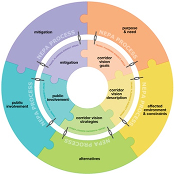
Program Maintenance
- Current projects for the program include the development of a new handbook to guide PEL projects in terms of organization, scope of work, and outcomes. Additional PEL training is in development.
- No changes to funding or maintenance have been made since the program started.
Critical Factors for a Successful Program
- Developing more effective guidance tools and providing better training have been important factors in the growing success of the program.
- Staff recognizing the need to accommodate the widest range of existing planning and project development studies in order to expand the program's utility.
- The program is “up and running,” but is still in its infancy and the future is uncertain. Its utility will depend, in part, on the outcome of the PEL handbook and other training initiatives.
- Guidance and direction has become such an important issue that if the program were being started today, developing a program handbook would be the first step.
For more information: http://www.coloradodot.info/programs/environmental/planning-env-link-program
Back to Top

GEOGRAPHIC INFORMATION SYSTEM & ENVIRONMENTAL SCREENING TOOL
Florida Department of Transportation
June 1, 2012
Program Elements
- Historic Preservation in Transportation Planning
- Historic Preservation in Early Project Development
- Interagency Cooperation and Collaboration
- Geographic Information Systems
- Historic Property Database
- Historic Property Screening Tool
- Historic Property “Red Flags”
- Process for Tribal Consultation
- Streamlined Decision-Making Process

Program Benefits
- By front-loading the historic preservation analysis (and other environmental analyses) into planning, using the ETDM program, project development moves more quickly, at less cost, and with fewer conflicts.
- Florida DOT (FDOT) has saved millions of dollars by not advancing projects that would have resulted in major conflicts with resource agencies and the public over environmental issues.
- One of the outcomes of the program is there is now greater engagement between FDOT and the resource agencies involving Section 106 reviews and other parts of the compliance process.
- The future outlook for the ETDM program is promising because the benefits of the program have been so great. It would be difficult for FDOT and the Florida division of FHWA to recreate another system that could be as rewarding.
Program Description
Florida's Efficient Transportation Decision-Making (ETDM) process assesses the potential environmental impacts of proposed transportation projects. This assessment, which is web-based, includes the consideration of historic preservation factors. Florida DOT (FDOT) and resource agencies par-ticipating in the program, including the Florida State Historic Preservation Officer (SHPO), evaluate the potential impacts of a proposed project using an on-line “Environmental Screening Tool” (EST). All environmental evaluations and communications related to these evaluations are performed, shared, and stored within the database. The creation of ETDM required restructuring the State's entire transportation planning process, in addition to establishing new dedicated funding for the program and the creation of new positions within the DOT to maintain ETDM. The program also required a commitment to develop and maintain a web-based GIS planning format.
Setting Up the Program
- Two individuals, one within FDOT, the other within what was the FHWA regional office in Atlanta, served as the program's “champions.” These two “champions” identified ways to merge the agencies' processes and programs, implement concurrent reviews, obtain early participation in the planning arena, and put in place the technology to make this all happen. Developing ETDM was a joint effort among FDOT, FWHA, and other state and Federal agencies, and local governments.
- There are two ETDM components: technology and agency operating-agreements. The latter includes funding agreements, if needed, whereby FDOT provides financial assistance to a resource agency so they can fully participate in the ETDM program. The resource agency uses these funds to hire staff (part- and full-time), or to hire a consultant to assist them in implementing ETDM. Each agreement was developed agency-by-agency and tailored to the agencies' processes. The agreements were signed by FHWA, FDOT, and the agencies.
- During the first two years (1999 and 2000), FDOT, in cooperation with FHWA, initially used state money and Transportation Equity Act - Section 1309 funds to develop ETDM. FDOT put in place the agreements with the resource agencies and provided funding to these agencies as needed. Then, FDOT, again in cooperation with FHWA, used State funds and surface transportation program (STP) funds to implement ETDM. FDOT took the necessary funds for ETDM “off the top” of STP funding.
- Initially, there was a big debate on how to implement ETDM. One option was as a pilot program or as a group of projects. The other option was to implement the program statewide. FDOT decided on the latter, holistic approach. When fully developed, FDOT would have in place a program that streamlines all of the DOT's projects. This would not have been possible if FDOT focused on a group of projects or ran ETDM as a pilot program. Based on the positive results of implementing ETDM statewide, a holistic approach was the correct choice.
Challenges Encountered
- Trust among the participating agencies was the big initial issue. Developing a new process like ETDM was a learning experience for everyone.
- Technology also was a challenge, since the tools needed to implement the program, such as the program and planning screens, did not exist. These tools had had to be created from scratch. There also were no models for the type of resource agency agreements required for implementing ETDM.
Program Maintenance
- FDOT has enhanced the program to support direct connectivity between the ETDM/EST system and the Florida Site File at the SHPO. The electronic files associated with the sites can be accessed from within the EST.
- There have been no changes to how FDOT funds and maintains the program. Nor have there been any program-specific impacts from the current economic environment because the program has a dedicated funding source.
- The one problem that has had an impact on the program relates to difficulty in retaining experienced personnel at the review agencies, which are FDOT's partners. The ETDM system is integrated by design so impacts on one component of the system (the review agencies) affect other parts of the system.
Critical Factors for a Successful Program
- Continued support and funding from the FHWA is vital to the program. FHWA was integral to the creation of the program and continues to be a major part of its success.
For more information: https://etdmpub.fla-etat.org/est/
Back to Top

GEOGRAPHIC INFORMATION SYSTEM & ENVIRONMENTAL SCREENING TOOL
Texas Capital Area Metropolitan Planning Organization
June 1, 2012
Program Elements
- Historic Preservation in Transportation Planning
- Interagency Cooperation and Collaboration
- Geographic Information Systems
- Historic Property Database
- Historic Property Screening Tool
- Historic Property “Red Flags”
Program Benefits
- The Capital Area Metropolotical Planning Organization's (CAMPO) program provides a holistic, long-range regional planning guide for future transportation projects.
- Identifies regional historic preservation constraints and opportunities that can be used to reduce future project costs and schedules, in addition to preserving places of historic and cultural value.
- Coordination between CAMPO, Texas DOT, and the Federal Highway Administration has strengthened because of the program.
Program Description
In 2006, the Capital Area Metropolitan Planning Organization (CAMPO) of central Texas improved its Geographic Information System (GIS) database as part of an update of its long-range regional plan. The database improvement and plan update were in response to Sections 6001 and 6002 of SAFETEA-LU. CAMPO is composed of Bastrop, Caldwell, Hays, Travis, and Williamson counties, centered on the City of Austin, the State capitol. To meet the needs of its growing population, CAMPO, in conjunction with Federal, state, and local agencies, sponsored three workshops or “summits” to update the regional plan. The first summit included a presentation by the Texas Department of Transportation (TxDOT) on their Geographic Information System (GIS) database - GIS Screening Tool (GISST). GISST defines and ranks areas of environmental concern within a proposed project area, producing a measure of “environmental significance.” TxDOT uses GISST as a screening tool to help evaluate environmental impacts of proposed projects under the National Environmental Policy Act (NEPA) review process. In subsequent summits (2008), participants added data to GISST, including information on historic properties, provided by the Texas State Historic Preservation Office (SHPO). CAMPO then incorporated GISST into its own GIS database, and generated a “Sum of All Criteria” map showing the combined environmental and historic property data for the region.
CAMPO continues to hold yearly meetings with resources agencies for planning purposes. In addition, CAMPO has introduced regional workshops into the program, where agencies can share new data and information. CAMPO is now in the process of incorporating another GIS screening tool, NEPAssist, into the project analysis process. NEPAssist, developed by the Environmental Protection Agency (EPA), is a web-based application that draws environmental data from EPA region GIS databases. In this manner, CAMPO continues to build its planning capabilities by using existing GIS environmental data and screening applications to produce analytical tools that are uniquely suited to its needs.
Setting Up the Program
- CAMPO established a working group composed of its regional planning partners, including the Texas Historical Commission (i.e., the SHPO), to provide input and guidance on updating the regional plan and improving the GIS database.
- The Planning Director at CAMPO was the driving force behind the effort to update the regional plan and improve the database. Prior to implementing this initiative, CAMPO staff had to secure approval on the technical aspects of the plan update from CAMPO's Technical Advisory Committee, and then had to convince the Transportation Policy Board on the value of the initiative.
- Four staff members, including the Planning Director and CAMPO's GIS expert, worked on the initiative. The initiative was funded using CAMPO's regular planning monies, and covered salaries, supplies and meeting costs.
Challenges Encountered
- CAMPO staff acquired a variety of data sets for updating their GIS database; however, the quality and outdated nature of some of the data presented problems.
- Historic properties were not originally included in the database; however, CAMPO staff subsequently asked the SHPO for their cultural resource GIS data, which the SHPO provided.
Program Maintenance
- CAMPO updated the long-range plan in 2010. These updates include analyzing projects using such tools as NEPAssist, which includes data from the National Historic Register of Historic Places. Integrating NEPAssist into the project development process is still in development.
- Program funding levels are the same as when the program was initially created.
- Having enough staff time devoted to the program remains the biggest challenge. Currently, CAMPO can only have one full-time staff person devoting one-third of their time to working on the required environmental analyses. CAMPO will add new program staff in 2012 and 2013, so this staff issue may be resolved soon.
- The current negative economic environment has actually helped the program in some ways. With fewer funds available for projects, regional partners seem to be more interested in getting projects to move more quickly, keeping the projects on schedule. This has resulted in better coordination among the regional partners, particularly in terms of environmental and historic property analyses.
- TxDOT is looking to improve the NEPA process, making it more efficient. In 2012, TxDOT will most likely be making changes to its environmental analysis requirements. This will result in increased coordination among agencies, and more responsibilities for the CAMPO local jurisdictions. There also may be an increased reliance on CAMPO's environmental analysis tools.
Critical Factors for a Successful Program
- Keeping the program moving forward in between long-range plan updates. The success of the CAMPO program requires ongoing workshops, meetings, and information exchanges in order to keep partners interested and active.
- When NEPAssist is fully incorporated, it may replace the GISST analysis. This would make the analysis more efficient and easier to incorporate into the planning process at all levels.
- The program's real success has come from strengthened coordination between CAMPO environmental planners and the TxDOT environmental staff who prepare NEPA documents. The roles and responsibilities of streamlining the NEPA analysis and determining what CAMPO can do to help that process are still evolving. In retrospect, the program would have been more successful if CAMPO had worked with its partners to establish clear roles and responsibilities for program coordination earlier in the planning process.
For more information: http://www.campotexas.org/programs_plan.php
Back to Top
APPENDIX A: STUDY METHODS AND ANALYSIS
Methods
Over the past 10 years, FHWA, several state departments of transportation (DOT), and local transportation planning organizations have implemented programs that consider historic preservation factors in planning and early project development. In 2009, the National Cooperative Highway Research Program (NCHRP) published a report on these types of programs. The report, entitled NCHRP Project 25-25, Task 49, Effective Practices for Considering Historic Preservation in Transportation Planning and Early Project Development, presents the results of a nationwide study conducted by Cambridge Systematics, Inc. (CS) and the SRI Foundation for NCHRP. The study involved a national survey and interviews to identify best practices that consider historic preservation factors in planning and early project development, focusing on how these practices improved historic preservation outcomes and the delivery of transportation projects.
In 2011, FHWA began the current project, which will disseminate nationwide the results of the NCHRP Task 49 study. Cambridge Systematics, Inc. and the SRI Foundation were contracted by FHWA to carry out this project, which includes the following elements: 1) developing case study summaries from a selection of best practices that consider historic preservation factors in planning and early project development; 2) compiling the case study summaries into a report and distributing the report to state DOTs, FHWA divisions offices, state historic preservation offices (SHPO), Tribal historic preservation offices (THPO), local transportation agencies, and historic preservation organizations; 3) posting the case study summaries on FHWA's historic preservation web site; 4) presenting the results of the NCHRP 25-25, Task 49 study and the current FHWA project via a national webinar; and 5) developing and delivering state-focused workshops for advancing best practices that consider historic preservation factors in planning and early project development.
To conduct the study and prepare this report, the SRI Foundation and CS, in consultation with FHWA, selected a sample of best practices/cases studies from the 2009 NCHRP Task 49 report, for inclusion in the FHWA project. The selected 16 case studies showcased programs developed by 12 state DOTs and one local transportation planning organization. In addition, the project team included a recent, innovative program developed by the Pennsylvania Department of Transportation in partnership with Preservation Pennsylvania: ProjectPATH. The 2009 case studies were then updated, examining the status of these programs and how they may have changed since the publication of the NCRHP report. The SRI Foundation contacted the state DOT and local organization staff associated with the selected case studies. Staff members were asked to review and update their respective program description as presented in the 2009 Task 49 report, and to complete a questionnaire about changes and updates to their programs. These staff either sent in their completed questionnaires, or chose to participate in a telephone interview where SRI Foundation staff went through the questionnaire, recording staff responses to the questions. Using the revised and updated program descriptions and questionnaire responses, the SRI Foundation drafted the case study summaries, which were then sent to the state DOTs and local planning organization for review. The case study summaries were finalized based on this review.
Questionnaires used to solicit updated program information from the state DOTs and local transportation planning organization staffs are presented in Appendix B.
Analysis
Each of the best practices presented in this report can serve as a model for achieving the goals of FHWA's Every Day Counts initiative, and in several cases, the goals of FHWA's PEL program. As indicated in Table A-1 below, nine of the programs address historic preservation issues in transportation system planning. Eight of the case studies describe programs that consider historic preservation factors as a part of early project development. Seven take into account the potential effects to historic properties in both planning and early project development.
Table A-1. Case Studies: Planning and Early Project Development
| Transportation Planning |
Early Project Development |
Planning and Early Project Development |
| Count: 9 |
8 |
7 |
| Colorado DOT (I 70 PA) |
VTrans (Delegation PA) |
Colorado DOT (I 70 PA) |
| North Dakota DOT (Tribal PA) |
Caltrans (SHPO Liaison) |
North Dakota DOT (Tribal PA) |
| Indiana DOT (Historic Bridges PA) |
Ohio DOT (SHPO Liaison) |
Indiana DOT (Historic Bridges PA) |
| Ohio DOT (Historic Bridges Program) |
Minnesota DOT ( MnModel) |
Ohio DOT (Historic Bridges Program) |
| Caltrans (Data Portal) |
North Carolina DOT (Archaeological Model) |
Caltrans (Data Portal) |
| Colorado DOT (PEL Program) |
Arizona DOT (Data Portal) |
Colorado DOT (PEL Program) |
| Florida DOT (ETDM) |
Virginia DOT (CEDAR) |
Florida DOT (ETDM) |
| NM DOT (Tribal Program) |
PennDOT (ProjectPATH) |
|
| Texas CAMPO (Regional Plan) |
|
|
Table A-2 below highlights the key elements associated with the case studies (see Appendix C for a more detailed discussion of these key elements). As seen in the case studies, the most common element is the use of GIS to identify the location and distribution of historic properties, in addition to other environmental factors. GIS has become an indispensable technology for environmental and historic preservation planning. Several agencies have enhanced their GIS databases by adding an environmental screening tool. This tool automatically identifies environmental and historic property constraints associated with proposed project alternatives. Some of these databases are also structured to identify “red flags,” which are historic properties that have the potential to impact the consideration of a project alternative or design. “Red flag” identification tools can be used to locate historic properties that are especially problematic, such as historic properties protected under Section 4(f) of the Department of Transportation Act. Two state DOTs also have used GIS as the foundation for archaeological sensitivity models that measure the potential for project alternatives to contain archaeological sites. Not only do these models measure archaeological sensitivity, they also can be used to determine the scope and cost of archaeological work within proposed project alternatives early in the project development process.
Table A-2. Distribution of Key Elements
| GIS/Historic Database |
Interagency Cooperation |
Red Flags |
PAs |
Screening Tool |
Streamlined Decision-making Process |
Tribal Consultation |
Archaeological Sensitivity Models |
| Count: 10 |
8 |
6 |
4 |
4 |
4 |
3 |
2 |
Mn DOT
(MnModel) |
Caltrans
(SHPO Liaison) |
Arizona DOT
(Data Portal) |
Colorado DOT
(I 70 PA) |
Virginia DOT
(CEDAR) |
Colorado DOT
(I 70 PA) |
North Dakota DOT (Tribal PA) |
Minnesota DOT
(MnModel) |
| North Carolina DOT (Archaeological Model) |
Ohio DOT
(SHPO Liaison) |
Caltrans
(Data Portal) |
North DOT Dakota
(Tribal PA) |
Colorado DOT
(PEL Program) |
VTrans
(Delegation PA) |
NM DOT
(Tribal Liaison) |
North Carolina DOT
(Archaeological Model) |
Indiana DOT
(Historic Bridges) |
NM DOT
(Tribal Liaison) |
Virginia DOT
(CEDAR) |
VTrans
(Delegation PA) |
Florida DOT
(ETDM) |
Colorado DOT
(PEL Program) |
Florida DOT
(ETDM) |
|
Ohio DOT
(Historic Bridges) |
Indiana DOT (Historic Bridges PA) |
Colorado DOT (PEL Program) |
Indiana DOT (Historic Bridges PA) |
Texas CAMPO (Regional Plan) |
Florida DOT (ETDM) |
|
|
Arizona DOT
(Data Portal) |
PennDOT
(Project PATH) |
Florida DOT
(ETDM) |
|
|
|
|
|
Caltrans
(Data Portal) |
Colorado DOT
(PEL Program) |
Texas CAMPO
(Regional Plan) |
|
|
|
|
|
Virginia DOT
(CEDAR) |
Florida DOT
(ETDM) |
|
|
|
|
|
|
Colorado DOT
(PEL Program) |
Texas CAMPO
(Regional Plan) |
|
|
|
|
|
|
Florida DOT
(ETDM) |
|
|
|
|
|
|
|
Texas CAMPO
(Regional Plan) |
|
|
|
|
|
|
|
When used in planning or early project development, these tools can result in 1) the elimination of project alternatives that have the greatest historic property impacts; or 2) the design of alternatives that have a minimal impact to historic properties and other environmental factors. If avoidance or minimization of impacts is not possible, mitigation options can be considered early in the project development process. This kind of fore-knowledge made available through the use of GIS reduces uncertainty in project development and delivery, and increases the predictability of project development outcomes.
Many of the case studies focus on tools that foster productive interagency cooperation and communication. A critical part of compliance with Section 106 of the National Historic Preservation Act is consultation among FHWA, the state DOTs, and the SHPOs, Tribes, and other consulting parties. Achieving effective consultation can be difficult because of the time and effort involved, often requiring multiple consultations over the life of a project. Tools that enable early consultation can significantly reduce project delivery schedules, and help identify significant historic preservation factors during the consideration of preliminary alternatives and project design. The Tribal consultation program case studies demonstrate the value of building relationships among Tribes and agencies outside of the project development process. Once these relationships are in place, all of the parties have a mutual understanding of how consultation is to proceed once the project development process begins. These types of programs bring predictability to the Section 106 consultation process.
Finally, several of the programs highlighted in these case studies use programmatic agreements (PA) as a means to formalize the process for early consultation with the Section 106 consulting parties, and as tools for establishing procedures that streamline historic preservation compliance in early project development. One state DOT, Indiana, used a PA to create a program for the management of the State's historic bridges, establishing procedures and protocols that can be applied to all future projects in the State that may affect a National Register eligible or listed historic bridge.
The case studies reveal many commonalities in terms of why and how these programs were created, and how they are maintained. The following is a list of these commonalities:
- Problem Being Solved - Each of the transportation agencies represented in this study recognized the need to effectively anticipate and, when possible, avoid potential problems involving historic properties. With increasing emphasis on improving transportation project delivery, these agencies saw the value of taking into account historic preservation issues during transportation system planning and early project delivery.
- GIS and Information Technology - A key element in most of the programs highlighted in the case studies involves the electronic collection, maintenance, and dissemination of historic property information, and making this information available to decision-makers early in system planning and project development. One challenge to the use of GIS and other IT tools identified by some of the transportation agencies was their own internal IT departments. In some cases, the development of these historic preservation-related IT tools was not recognized as a Departmental priority and IT support was not readily forthcoming. In these situations, state DOT historic preservation staff had to create some “work-arounds” in order to develop and put in place their respective programs.
- Funding - Program funding has come from a mix of state and Federal sources. Transportation Enhancement grants were an important funding source for initiating several of the programs. State Planning and Research monies also were used to fund programs deemed a “critical transportation planning tool.” Generally, once a program is established, state funds are used for maintenance and staff salaries. A few of the programs were created and maintained using only state transportation funds.
- Upper Management Support - As noted in the 2009 NCHRP Task 49 report, almost all of these programs were created as a result of the efforts of one or more “champions” within a transportation agency. These individuals were the catalysts for advancing a program. These programs, however, could not exist without the initial and continuous support of an agency's upper management.
- Staffing - Staffing is a common challenge among most of the programs. State budget cuts, hiring freezes, and staff turn-around all have the potential to affect the efficacy of these programs; however, each transportation agency has implemented steps to ensure that their programs continue despite these challenges.
- Benefits - Each transportation agency has benefited from their decision to change how they address historic preservation issues during transportation planning and early project development. A problem was recognized, solutions were proposed, and new procedures and technologies were adopted, resulting in more effective ways to reduce or avoid delays and increased costs in project delivery. These programs also result in improved historic preservation outcomes.
Back to Top
APPENDIX B: QUESTIONNAIRES
Questionnaire on the Status of Your Program
- Have you made any changes to your program? If so, why were these changes made and what are the results of these changes?
- Have you changed how you fund and maintain the program?
- Are you encountering any obstacles or problems to maintaining the program? If so, how are you addressing these obstacles or problems?
- What are the most critical factors in continuing to have a successful program?
- Have any new unexpected but still beneficial outcomes resulted from the program?
- How is the current economic environment affecting the program? Have changes in your agency's budget affected the program? If they have, how have they affected the program?
- How are current and anticipated transportation project priorities affecting or will affect the program?
- What does the future look like for the program?
- What would you do differently if you were starting the program today?
Questionnaire on the Status of Your Programmatic Agreement
- Have you made any amendments to the PA since its execution? If so, why were these changes made and what are the results of these changes?
- Are you encountering any obstacles or problems in implementing the PA's stipulations? If so, how are you addressing these obstacles or problems?
- Have the current economic environment and/or your agency's project priorities affected implementation of the PA? If they have, in what way have they affected implementation of the PA?
- What factors are most critical for successfully implementing the PA?
- Have any new unexpected but still beneficial outcomes resulted from the PA?
- What would you do differently if you were starting the preparation of the PA today?
Back to Top
APPENDIX C: DESCRIPTION OF APPROACHES AND KEY ELEMENTS USED IN BEST PRACTICES
Approaches
- Programmatic Agreements (PA). Programmatic agreements establish a process for Section 106 consultation for a specific project, a class of projects, or a category of historic properties. PAs also can establish how an agency will carry out its Section 106 responsibilities for a program, such as the management of a state's historic bridges. PAs are usually prepared during planning or early project development.
- Liaison Program. These are programs in which 1) state DOT's fund one or more position in the state historic preservation office in order to facilitate and expedite transportation project reviews; or 2) have on staff a dedicated individual who serves as a liaison between a state DOT and Tribes.
- Archaeological Predictive Modeling. Some states have developed a Geographic Information System (GIS) tool that maps areas of differential archaeological sensitivity. This tool is used as a means to anticipate the quantity and types of archaeological sites that may be present within a proposed project area.
- Historic Bridges Management Program. These programs establish procedures and protocols for the identification, evaluation, and management of historic bridges.
- Rights-of-Way Cultural Resource Databases/Portals. These GIS-based tools are designed to store and make readily accessible information on historic properties located within state DOT rights-of-way. This information includes state DOT correspondence with review agencies, property inventory forms, reports, property maps, etc.
- Internal Project Development Database. This is an internal program that organizes all environmental data into one system, accessible to state DOT staff. These date include information on historic properties, specific project documents, forms, and images.
- Collaborative Transportation Planning and Early Project Development Process. These consist of on-line platforms for the posting and exchange of historic preservation, environmental, and project information among FHWA, state DOTs, and SHPOs, and other resource agencies.
- On-Line Section 106 Consulting Party Communication Tool. This on-line tools helps state DOTs identify potential consulting parties for proposed projects during planning and early project development. The tool also is used to communicate with the consulting parties, providing them with ongoing project information.
- Geographic Information System and Environmental Screening Tool. These programs house environmental and historic property data within a GIS that is accessible to state DOT staff, in addition to FHWA and resource agencies. These programs also are designed to electronically “screen” for the presence of historic properties, along with other environmental resources during planning and the preliminary evaluation of project alternatives during NEPA review. This screening tool identifies historic preservation and environmental constraints and “red flags” that may affect the location and design of project alternatives under consideration.
Key Elements
- Historic Preservation in Transportation Planning. The program takes into account historic preservation factors during transportation system planning.
- Historic Preservation in Early Project Development. The program considers historic preservation factors during early project development (i.e., during the NEPA review process).
- Interagency Cooperation and Collaboration. The program is designed to facilitate interagency communication and cooperation on matters relating to historic preservation.
- Geographic Information Systems. The use of a GIS is an integral part of the program.
- Historic Property Database. The program includes an electronic historic property inventory/database.
- Historic Property Screening Tool. The program is designed to electronically “screen” for the presence of historic properties, among other environmental resources.
- Historic Property “Red Flags.” One of the program's functions is to identify potential historic properties that have might affect the consideration of a project alternative or design.
- Identification and Mapping of Archaeological Sensitivity. The program is designed to identify areas of archaeological sensitivity and the potential locations of classes of archaeological sites.
- Programmatic Approaches to Identifying, Evaluating and Managing Historic Properties. The program is designed to streamline Section 106 compliance, and to direct the Section 106 parties to consider historic preservation issues early in the project development process. These efforts are often codified in a formal programmatic agreement.
- Process for Tribal Consultation. The program is designed to facilitate consultation with Tribes regarding historic properties of religious and cultural significance to Tribes.
- Streamlined Decision-Making Process. The program establishes procedures and protocols for early consultation and decision-making among participating agencies and organizations.
Back to Top
APPENDIX D: INDEX OF CASE STUDIES
(In Alphabetical Order)
Arizona DOT (ROW Database Portal)
Caltrans (ROW Database Portal)
Caltrans (SHPO Liaison Program)
Colorado DOT (PEL Program)
Colorado DOT (I 70 Mountain Corridor Tiered EIS PA)
Florida DOT (ETDM)
Indiana DOT (Historic Bridge Program
Minnesota DOT (Archaeological Predictive Model)
New Mexico DOT (Tribal Liaison Program)
North Carolina DOT (Archaeological Predictive Model)
North Dakota DOT (Tribal Consultation PA)
Ohio DOT (Historic Bridge Program)
Ohio DOT (SHPO Liaison Program)
Pennsylvania DOT and Preservation Pennsylvania (ProjectPATH)
Texas (Capitol Area MPO)
Vermont Transportation Agency (Section 106 Delegation PA)
Virginia DOT (CEDAR)
Back to Top

