Using Road Diets to Advance Healthy, Safe Communities
The Federal Highway Administration (FHWA) is advancing a low-cost proven safety countermeasure called a Road Diet, which can improve safety, livability, and health for communities across the nation. A Road Diet is an innovative approach to addressing high crash rates and other issues facing motor vehicles, cyclists, and pedestrians. In fact, studies have shown that implementing a Road Diet can result in a 19 to 47 percent reduction in overall crashes, and allow for a bounty of additional community benefits.
FHWA’s soon-to-be-released Road Diet Informational Guide offers insights into this unique approach, drawing upon research and practice from across the country. With a focus on classic Road Diets, the guide walks practitioners through the decisionmaking process, including safety, operational, and quality-of-life considerations, providing all the information needed to plan, design, and implement a Road Diet. The guide also references real-world examples from a variety of States and localities to showcase how different agencies have developed, employed, and evaluated Road Diets.
Anatomy of a Road Diet
A Road Diet removes travel lanes from a roadway and allocates the available space for other uses. The most common type of Road Diet is a “classic Road Diet,” which converts an existing four-lane undivided roadway to three lanes—two through lanes and a center two-way left-turn lane. This opens up space, allowing the extra width of the roadway to become bicycle lanes, pedestrian refuge islands, on-street parking, transit stops, and more. The new configuration improves safety by including a protected left-turn lane for mid-block left-turning motorists, reducing crossing distance for pedestrians, and reducing travel speeds, which in turn help to decrease crash severity.

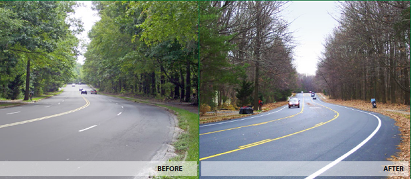
Before and after images show a conversion of an undivided four-lane roadway to a three-lane undivided roadway with two through lanes and a center two-way left-turn lane. (Courtesy of Virginia Department of Transportation)
Across the United States, many roads were constructed with peak flow in mind, when in reality these roadways may have excess capacity for most periods of the day. In some cases, practitioners have adopted a “less is more” attitude for these roads, putting superfluous four-lane highways on a diet. However, Road Diets are not the right solution for every roadway.
FHWA’s Road Diet Informational Guide summarizes numerous factors to consider when determining the feasibility of a site for a Road Diet. For example, one of the operational factors to consider is Average Daily Traffic (ADT), which provides a good first approximation on whether or not to consider a Road Diet conversion. FHWA advises that roadways with an ADT of 20,000 vehicles or less may be good candidates for a Road Diet and should be evaluated further for feasibility.
Case Studies Emphasize Safety, Livability, and Economic Benefits of Road Diets
Road Diets Offer Benefits Across the Board
As highlighted in the Road Diet Informational Guide, FHWA sees Road Diets as a win-win for quality of life, creating healthier communities via several key areas:
Safety
- Road Diets reduce crash rates by 19 to 47 percent.
- The rate of rear-end and left-turn crashes decreases through the use of a dedicated left-turn lane.
- Pedestrians have fewer lanes to cross and pedestrian refuge islands may be installed.
- Reallocated cross-section width allows for the installation of bike lanes.
Livability
- Road Diets are effective avenues to achieving “complete streets” by providing opportunities to accommodate all road users.
- The addition of bicycle lanes and pedestrian enhancements, such as traversable medians, encourages and increases use of those modes, contributing to a reduction in carbon emissions along the corridor.
- Landscaped, traversable medians not only increase the community’s green space, but also the aesthetic beauty of the area.
Economy
- A Road Diet can be a low-cost safety solution when the installation is coordinated with scheduled pavement marking modifications or planned in conjunction with reconstruction or simple overlay projects.
- New buffers and the addition of on-street parking and transit stops can increase business to local shops, as storefronts become more easily accessible.
- Bike lanes, pedestrian improvements, and transit stops make it easier for travelers, especially commuters, to get to where they need to go.
Road Diets date back to the late 1970s, becoming more widespread and popular during the 1990s. In recent years, more and more States and localities have installed and evaluated the impact of Road Diets. The following case studies are drawn from the Context Sensitive Solutions webinar on Rightsizing Streets, which was sponsored by FHWA. The case studies provide examples of how Road Diets offer communities safety, livability, and economic benefits (see the text box to the right for more details on the advantages of Road Diets).
East Boulevard, Charlotte, North Carolina
The Dilworth neighborhood in Charlotte, North Carolina sought to return the “boulevard” to East Boulevard, a 35 mile per hour (MPH) road including offices, retail centers, multi-family homes, a major hospital, a park/greenway, and a bus route. Community members wanted the road to be safer and more comfortable for all modes of travel, enhance activity along the sidewalks, allow pedestrians to safely cross the street, and increase the installation and use of sidewalk cafés and outdoor seating.
The Charlotte Department of Transportation (CDOT) saw the opportunity to implement a Road Diet along a 1.5-mile stretch of East Boulevard. To advance the project, CDOT understood the importance of community involvement in planning. Consequently, they created project advocates by working with local residents and businesses early in the process and conducting detailed traffic simulations to test and show expected results.
CDOT carried out the project in several phases. Phase 1 focused on the conversion of a 40-foot-wide segment of East Boulevard from four lanes into two 15-foot through lanes with a center two-way left-turn lane and traversable medians throughout. The redesigned roadway also included bike lanes in both directions.
In Phase 2, a 70-foot-wide portion of the four-lane roadway was similarly converted, creating two through lanes with a center two-way left-turn lane and adding traversable medians, crosswalks, and a bike lane.
Finally, Phase 3 focused on the stretch of roadway connecting Phases 1 and 2, and included a two-way center lane for left-hand turns, mid-block pedestrian refuge islands, and bike lanes.
The completed project led to less speeding, a decrease in crashes, and praise from the community. More specifically:
- Travel times remained constant.
- The 85 percent speed (the value many States and cities use for establishing regulatory speed zones) declined from 43 to 40 MPH. Prior to the changes, some vehicles were traveling 50 to 70 MPH.
- Overall crashes decreased along the Phase 1 segment from 2.64 to 1.67 crashes per month.
- Crashes decreased along the Phase 2 segment from 1.97 to 1.86 crashes per month.
- Outdoor dining significantly increased.
- After Phases 1 and 2 were implemented, 77 percent of people in a public survey supported implementing a Road Diet in Phase 3, praising the increased safety of the road for drivers, bicyclists, and pedestrians.

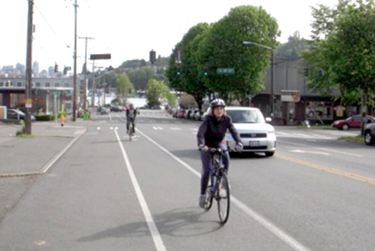
Seattle’s Stone Way Road Diet resulted in an increase in bicycle volume by 35 percent. (Courtesy of the SDOT)
Stone Way, Seattle, Washington
Using a “complete streets” approach, Seattle’s goal is to create streets that are safe, convenient, and accessible to everyone—in some cases, using Road Diets as a tool to achieve this mission. The Seattle Department of Transportation (SDOT) identifies Road Diet candidates by reviewing capital projects for complete streets applications, the city’s Bicycle and Pedestrian Master Plans, and community requests for neighborhood plan implementation. It funds projects through Bridging the Gap—a nine-year levy for transportation maintenance and improvement—and by capitalizing on State and Federal grants.
As part of the completion of Seattle’s bicycle and pedestrian network, SDOT prescribed a Road Diet for Stone Way, a 30 MPH, 1.2-mile long street with four general purpose travel lanes, uncontrolled marked crosswalks at four intersections, and no bicycle facilities. Within five blocks of Stone Way, there are eight schools, two libraries, and five parks. The street’s ADT prior to the Road Diet was 13,000.
Stone Way was rechanneled to two general travel lanes, a two-way left-turn lane, and bike facilities (a combination of bike lanes and shared lanes). After implementation, Stone Way’s Road Diet proved to be effective as:
- There was a 75 percent reduction in the percentage of drivers 10 miles over the speed limit.
- ADT declined by 6 percent.
- Peak volume traffic dropped by 5 percent.
- Crashes declined by 14 percent.
- Injuries declined by 33 percent.
- Pedestrian collisions declined by 80 percent.
- There was a 6 percent reduction in motor vehicle traffic and an increase in bicycle volume by 35 percent, which represented almost 15 percent of peak hour traffic volume.
Overall, Stone Way’s Road Diet reduced collisions and aggressive speeding along the roadway, made pedestrian crossings safer, increased bicycle volume, and kept traffic from diverting to neighborhood streets.
Determining If Road Diets Are Right for You
A Road Diet is a valuable, accessible tool for addressing highway challenges and advancing community wellness. With safety, livability, and economic benefits, a Road Diet can be a truly effective solution, but it is not right for every road. FHWA’s Road Diet Informational Guide helps practitioners evaluate whether or not a roadway is a good candidate for a diet, and acts as a one-stop-shop for information and guidance when moving forward with planning and implementation.
Contact Information
Becky Crowe
Office of Safety
Federal Highway Administration
(804) 775-3381
Rebecca.Crowe@dot.gov
Look What’s New!
- FHWA published a handbook to help State departments of transportation (DOTs) develop or update State pedestrian and bicycle plans. The handbook draws upon recent experiences and noteworthy practices in preparing and implementing pedestrian and bicycle plans.
- The U.S. Environmental Protection Agency released a report highlighting carbon dioxide emissions, fuel economy, and technology trends for light-duty vehicles. The report draws upon data from model years 1975 through 2014. To view the report, click here.
- FHWA recently hosted two webinars on the Infrastructure Voluntary Evaluation Sustainability Tool (INVEST). One webinar focused on how INVEST is helping DOTs build sustainable transportation. The second webinar addressed how MPOs are advancing sustainability in transportation planning with INVEST. To access the recordings, click here.
Successes in Stewardship is a Federal Highway Administration newsletter highlighting current environmental
streamlining and stewardship practices from around the country. Click here to subscribe, or call (617) 494-3539 for more information.

