Archeology
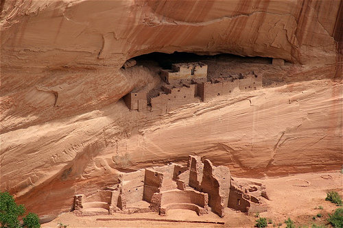 White House Ruins at Canyon de Chelly, Arizona. Ruins of
Indian villages built between AD 350 and 1300 can be found at the base of the sheer red cliffs and in canyon wall caves.
The Federal Highway Administration (FHWA) provides guidance and technical assistance to Federal, State, and local government staff regarding Federal laws, regulations, policy, and procedures on archeological topics.
To find contacts at the Office of Project Development and Environmental Review with knowledge of archeological and other historic preservation topics, visit the contacts page.
ACHP Section 106 Archeology Guidance
The Advisory Council on Historic Preservation (ACHP) has developed an interactive website that posts archeology guidance in the context of compliance with Section 106 of the National Historic Preservation Act. This website is presented in an interactive, Web-based format as a series of questions and answers. It is designed to be a dynamic document, with examples used to illustrate the points and perspectives made here.
Each question has a unique answer. However, the answers complement each other in such a way that, when considering a specific question or topic, the user is strongly encouraged to access links to other answers and their questions, as suggested. Also, links to pertinent federal law, regulation, standards, and guidance are provided. Accessing this additional information offers the user a more thorough explanation of the topics. Visit: https://www.achp.gov/heritage_tourism

