11th Street Bridges, Washington DC
Case Study Introduction
Project Overview
The District Department of Transportation (DDOT) and the Federal
Highway Administration (FHWA) initiated the 11th Street Bridges
project in 2005 to improve the highway connection between the
Southeast/Southwest Freeway (I-695) and the Anacostia Freeway
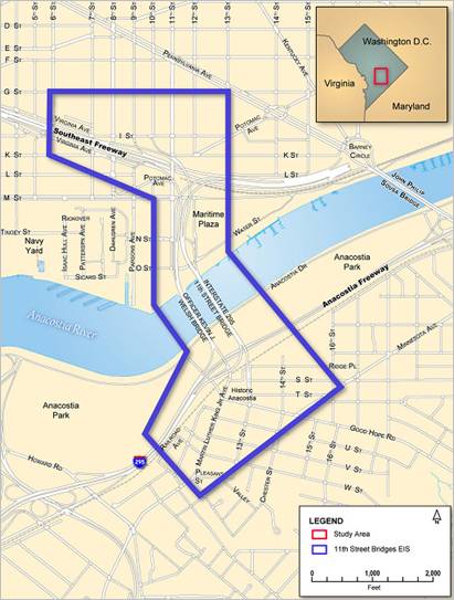
(I-295 and DC-295) in southeast Washington DC. The project study
area is shown in Figure 1. The project was to replace obsolete
infrastructure, provide missing freeway connections to improve
traffic flow to and from downtown Washington DC, discourage
cut-through traffic on neighborhood streets, improve local access,
and better link land uses across the Anacostia River.
Figure 1: Map of the 11th Street Bridges study area
When the Southeast/Southwest Freeway was built in the mid-1960s,
regional plans expected it to extend across the river and then join
the Anacostia Freeway. However, those plans were abandoned, and
today there is no direct connection between the Southeast/Southwest
Freeway and the Anacostia Freeway to the north of the 11th Street
Bridge complex. Traffic, therefore, is forced to use neighborhood
streets to access the 11th Street Bridge complex and cross the
Anacostia River. The result is increased traffic on local
neighborhood streets, such as Martin Luther King, Jr. Avenue, Good
Hope Road, Pennsylvania Avenue, and Minnesota Avenue.
The 11th Street Bridge/Anacostia Freeway interchange does not
allow traffic east of the Anacostia River to enter the Anacostia
Freeway at this location. Drivers may cross the 11th Street Bridge
toward downtown Washington DC or return, but they cannot enter or
leave the Anacostia Freeway without taking neighborhood streets to
adjacent interchanges at Pennsylvania Avenue, Howard Road, or South
Capitol Street.
Because the project involves reconfiguring the ramps on either
shore but does not involve adding capacity to the freeway system,
the project termini are where the ramps merge back into the
existing freeway.
DDOT and FHWA signed the Draft Environmental Impact Statement
(DEIS) in June 2006, the Final Environmental Impact Statement
(FEIS) in September 2008, and the Record of Decision in July 2009.
Construction of the $300 million project is now under way (as of March
2010).
Planning History
The 11th Street Bridges project is a key component in District
of Columbia’s plans to revitalize the Anacostia riverfront.
In March 2000, federal and District agencies signed an agreement
forming the Anacostia Waterfront Initiative (AWI) to transform the
Anacostia River into a revitalized urban waterfront. The AWI
brought together 20 federal and District agencies that own or
control land along the Anacostia River to sign the AWI Memorandum
of Understanding, creating a partnership between the federal and
District governments to transform the Anacostia River waterfront.
With Washington DC’s downtown nearly built out, the city is
growing eastward toward and across the Anacostia River. The
District is committed to recentering its growth along the Anacostia
River and improving long-neglected parks, environmental features,
and infrastructure in the area. The 11th Street Bridges project
falls within the context of the AWI and other planning activities
within the project area.
The AWI fostered a number of transportation studies, one of
which was the Middle Anacostia River Crossings Transportation Study
(MAC Study). The study was undertaken to evaluate traffic
conditions and to recommend options to improve bridge and bridge
and roadway connections between the 11th Street and John Philip
Sousa Bridges to enhance mobility on both sides of Anacostia River.
The study proposed several short- and long-term improvements that
include completing the 11th Street Bridge ramps to I‑295,
reestablishing Barney Circle as an actual circle, separating the
interstate (regional) traffic from the local traffic, riverfront
access improvements, signage improvements, and pedestrian
improvements. The findings and recommendations in the MAC Study
formed the basis of the 11th Street Bridges’ alternative
development and evaluation process.
Purpose and Need
The purpose of the 11th Street Bridges Project is fourfold:
- Reduce congestion and improve the mobility of traffic
across the Anacostia River on the 11th Street Bridges and on the
local streets in the area.
- Increase the safety of vehicular, pedestrian, and bicycle
traffic in the Anacostia neighborhood.
- Replace deficient infrastructure and roadway design.
- Provide an alternative evacuation route and routes for
security movements in and out of the nation’s capital.
The following transportation needs are to be met by the
project:
- Improve Access and Reduce Congestion—Provide
missing access to the Anacostia Freeway. Reduce volume of freeway
traffic that spills onto the neighborhood streets due to current
traffic patterns.
- Enhance Safety—Provide safe pedestrian and bicycle
access across the river and to the Anacostia waterfront. Correct
roadway design elements that reduce safety and result in
congestion. Reduce number of vehicular crashes in the project
interchanges.
- Correct Design Deficiencies—Replace bridges that
are functionally and structurally obsolete. Improve signage in the
project area to reduce confusion.
- Augment Homeland Security—Upgrade evacuation route
for the nation’s capital and area military installations.
Travel Forecasting Summary
The Metropolitan Washington Council of Governments (MWCOG) model
was used to generate traffic forecasts for the 2030 design year.
The MWCOG model, which simulates transportation and land use
conditions in the greater Washington DC region, encompasses more
than 4,000 square miles. The model was developed to provide a basis
for predicting the overall expected travel trends in future years,
based on planned land-use development and highway network scenarios
at the regional level. MWCOG’s model, which uses Version 2.1D
#50 of Citilab’s TP+ program, meets USEPA requirements for
air quality conformity analysis. It incorporates land use
assumptions from MWCOG’s Round 6.4A. The Cooperative
Forecasting Program, administered by the MWCOG, enables local,
regional, and federal agencies to coordinate planning using common
assumptions about future growth and development in the region. Each
series of forecasts, or “round,” provides land use
activity forecasts of employment, population, and households by
five-year increments. Each round covers a period of 20 to 30 years.
Round 6.4A represented the most recent land use forecast available
at the time the travel forecasting work was carried out.
DDOT obtained a copy of the MWCOG model for use in forecasting
the 11th Street Bridges traffic volumes. Forecast traffic volumes
from the model were used for traffic operational analyses, air
quality conformity analyses, and traffic noise analyses. The
traffic forecasts were used to assess and compare travel conditions
under a No-Build Alternative and each of the build alternatives.
The following traffic/transportation analyses were completed for
each of the alternatives:
- Prediction/modeling of future traffic and travel
patterns
- Analysis of future traffic operations
- Comparison of access changes to key land uses or
areas
- Analysis of travel times
- Evaluation of vehicular safety considerations
- Evaluation of impacts to pedestrians
- Evaluation of impacts to bicyclists
- Evaluation of impacts to transit operations
- Evaluation of impacts to freight
Case Study Illustration of the Guidance
The 11th Street Bridges project provides a good illustration of
one of the key consideration contained in FHWA’s Guidance
on the Application of Travel and Land Use Forecasting in NEPA.
It was clear to the project team from the start that while
MWCOG’s regional model can be effective in answering
big-picture questions, it would be ineffective, without
modification, in answering such project-specific questions as
“What will be the effect of adding missing freeway
connections to traffic volumes east and west of the Anacostia
River?” Performing the upfront work, using the latest
available data to refine the part of the regional model within the
project study area, convinced DDOT, FHWA, and USEPA that the team
was able to credibly compare alternatives in a forecast setting.
This allowed the project team to proceed through the alternatives
development and refinement phase in an efficient manner and to keep
the fast-paced study on schedule. This case study emphasizes
consideration 2 of the guidance: Suitability of Modeling Methods,
Tools, and Underlying Data.
Key Consideration 2 of the Guidance: The Suitability of
Modeling Methods, Tools, and Underlying Data
Age of Forecasts, Models, Data, and Methods
The first travel demand model was run in 2004 under DDOT's MAC
Study, before the start of the 11th Street Bridges EIS. This gave
DDOT enough data to determine that the best solution to the
inefficient connections between the east and west sides of the
Anacostia River in the study was to reconfigure the 11th Street
Bridges interchange (rather than building a flyover at Pennsylvania
Avenue, which had been proposed in the past).
In 2005, DDOT hired CH2MHILL to develop an EIS to evaluate
replacing the 11th Street bridges and reconstructing the east-side
interchange. For the DEIS, the travel demand model was run with the
2005 version of the MWCOG model. The MWCOG model network was
refined for the 11th Street Bridges Study to represent future
roadway networks based on transportation projects in MWCOG’s
2004 update to the Constrained Long-Range Plan and major projects
in the FY2005–2010 Transportation Improvement Program. Both
plans represented the most current information available at the
start of the 11th Street Bridges project. The land use and other
inputs to the MWCOG model were not changed for the purpose of the
study. Because DDOT committed to no new net capacity on the system
as a result of the 11th Street Bridges project, the emphasis was
placed correctly on travel demand rather than land use. During the
preparation of the DEIS, a new MWCOG model had been released with
new land forecasts, so the project’s travel demand model was
run again using the 2007 model. The project’s FEIS, ROD, and
Interchange Justification Report were completed with the data from
the 2007 model.
Calibration, Validation, and Reasonableness Checking of Travel
Models
As noted, the MWCOG model simulates transportation and land-use
conditions for a region around Washington DC encompassing more than
4,000 square miles. To allow a meaningful comparison between the
traffic impacts of the project’s Build and No-Build
alternatives within the study area, which constitutes a very small
area within the regional model, the project team identified the
boundaries of an area (subarea) that would be the focus of the
project’s travel demand modeling efforts.
After receiving the 2005 version of the 2030 no-build model from
MWCOG for the subarea identified above, the project team performed
a quality check on the data within the subarea. The initial step in
the quality check was to review documentation MWCOG published
(FY-2004 Network Documentation: Highway and Transit Network
Development, November 17, 2004) that listed all the roadway
network assumptions in the model. In addition, the project team
reviewed the Constrained Long-Range Plan, the Transportation
Improvement Program, and DDOT’s AWI Transportation Master
Plan for consistency and to determine which projects were included
in the 2030 no-build forecast. The review uncovered the fact that
the MWCOG model included all regional programs identified in the
Constrained Long-Range Plan and Transportation Improvement Program,
but no projects from the AWI Transportation Master Plan. The Master
Plan lists 16 transportation projects, including the 11th Street
Bridges and South Capitol Street Bridge projects, in the AWI study
area and a proposed construction sequence. Because of limitations
in funding and the expectation that not all these projects will
affect traffic patterns or demand, it was determined that most of
the Master Plan’s projects should not be included in the
forecast traffic models. The two exceptions were the 11th Street
Bridges and South Capitol Street Bridge projects, which are major
improvements with dedicated funding and expected significant
changes to the travel patterns in the AWI area. After coordination
with FHWA, MWCOG, and USEPA, it was agreed that the 11th Street
Bridges Project 2030 no-build model would be modified to include
the assumed completion of the South Capitol Street Bridge Project.
Likewise, the South Capitol Street Bridge Project 2030 no-build
model roadway network would be modified to include the assumed
completion of the 11th Street Bridges Project.
After resolving the range of projects to include in the 2030
no-build network, the team analyzed the roadway network in the
immediate study area (subarea) and identified discrepancies between
the MWCOG model roadway network and the study area roadway network.
This was done by comparing data on the local road network contained
in the project’s Existing Conditions Report to the
model’s roadway network. The project team updated the subarea
network by adding links and nodes not present in the regional
model, modifying the number of lanes on network links, and
incorporating (or removing) turn prohibitions at intersections.
Following the initial cleanup described above, the subarea model
was plugged back in the MWCOG regional model, and the model was run
to check the output against existing conditions in the study area.
The final revisions to the subarea model were then made. At that
point, the project team was able to code the 2030 build networks
using the revised 2030 no-build network and make modifications
reflective of the roadway designs for the project’s four
build alternatives.
Refining the MWCOG model to reflect the transportation system
characteristics within the 11th Street Bridges study area was
critical to developing a no-build model that the project team and
regulatory agencies trusted to reasonably represent the traffic
impacts of the build alternatives. Without the modifications made
by the team, the gross level of detail in the regional model would
not have been able to identify the traffic performance distinctions
among relatively similar build alternatives. As noted in the DEIS,
all build alternatives “provide the same basic traffic
service by providing eight freeway lanes and four local lanes over
the Anacostia River along the same basic alignment as the current
crossings. They all achieve separation of freeway traffic from
local street traffic, and they all provide a safe river crossing
for pedestrians and bicyclists. Every build alternative is designed
to provide direct ramp connections, which do not currently exist,
from the Anacostia Freeway north of 11th Street to I-295 over the
Anacostia River. Every build alternative provides common ramp and
access schemes for traffic west of the river.”
For projects such as the 11th Street Bridges that base purpose
and need, in part, on addressing traffic deficiencies (improve
access and reduce congestion; provide missing access to the
Anacostia Freeway; reduce volume of freeway traffic that spills
onto the neighborhood streets due to current traffic patterns), the
inability to draw reliable traffic differences among alternatives
eliminates traffic performance as an alternative screening
consideration and makes it uncertain whether the alternatives
ultimately serve purpose and need.
Additional Background and Sources
FEIS and ROD
The FEIS was produced as a two volume set. Chapter 4, Purpose
and Need, 5, Alternatives, and 8, Traffic and
Transportation Analyses, of the FEIS were sources of
information for this case study. Appendix B of Volume 2, Traffic
and Transportation, was also a reference.
DDOT and FHWA signed the Draft Environmental Impact Statement in
June 2006, the Final Environmental Impact Statement in September
2008, and the Record of Decision in July 2009. Construction of the
$300 million project is now under way (as of March 2010).
Contacts
- Bart Clark
- District of Columbia Department of Transportation
- Director, Anacostia Waterfront Initiative
- 64 New York Avenue, NE
- Washington, DC 20002
- (202) 671-4696

