
Project Examples
FINDING OF NO HISTORIC PROPERTIES AFFECTED
This example illustrates a situation where project activities are so minimal that there is no alteration to the characteristics of a historic property that qualify it for inclusion in the National Register.
Overview
The State DOT proposed reconstruction of a 3.4-mile section of state highway to include milling existing pavement and overlaying with new pavement and concrete patching to repair deteriorated curb and gutter. The highway is a four-lane (two lanes in each direction) urban arterial of varying width flanked by curb and gutter. The project, located within existing right-of-way, did not expand or alter the footprint of the roadway, curb, and gutter. As part of the project, the wingwalls of an existing bridge carrying the roadway over a creek required some concrete patching, drainage upgrades at the bridge approaches to help drain water away from the bridge, and utility relocation near the bridge. This involved some minor ground disturbance at the bridge corners and along the banks of the creek.
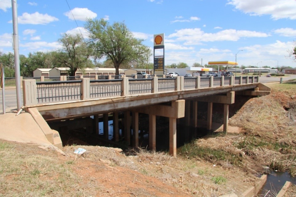
Two previously identified archaeological sites are located in a park adjacent to the bridge. Proposed activities near the bridge include utility relocation, wingwall patching, and drainage improvements. Photograph courtesy of Mead & Hunt.
Identification of Historic Properties
FHWA and the State DOT consulted with Tribes and other consulting parties, none of which raised concerns or issues about the project. The Area of Potential Effects (APE) for built environment resources initially included all properties located adjacent to the roadway that may be directly or indirectly affected. FHWA consulted with the State Historic Preservation Officer (SHPO) on the APE, and the SHPO agreed with FHWA on the definition of the initial APE. Qualified professional historians conducted a survey and identified two residential historic districts and one commercial historic district that had potential to meet the criteria for listing in the National Register. One previously determined National Register-eligible church property was also found in the survey. Even though proposed project activities were to be limited to the existing right-of-way and a small area at the bridge corners and along the creek bank, having a larger initial APE and conducting a historical survey of adjacent properties provided the State DOT with flexibility in case the design needed to change as project development progressed.
The APE for archaeology was defined to encompass the areas of proposed ground disturbance near the bridge and along small portions of the creek. A qualified professional archaeologist conducted an archaeological survey and confirmed the presence of two previously identified archaeological sites within the APE near the creek. The archaeological survey confirmed that the boundaries of previously identified sites were well beyond the limits of project activities. FHWA and the State DOT consulted with the Tribes about the results of the archeological survey, and the Tribes did not raise any concerns. However, they did note that they should be contacted if the project limits are changed and, as a result, extended into the boundaries of the sites. FHWA and the State DOT shared the results of their consultation with the Tribes with SHPO. SHPO reviewed the report on the archeological survey and concurred with the survey findings.
Issues Considered
- Though proposed project activities were limited to the existing right-of-way, the historical survey accounted for resources adjacent to proposed activities so the project team is aware of historic properties that could be affected should small design adjustments be necessary during project development. For this reason, the initial APE included the first row of buildings along either side of the road. The historic districts were found to extend beyond these limits.
- Discussions between historians and project engineers after the survey confirmed the minimal nature of project activities with no work extending beyond the back edge of curb except for near the bridge. With project details confirmed, the final APE was then narrowed to include only the project roadway.
- By refining project limits as part of the design development, it was possible to achieve a finding of No Historic Properties Affected.
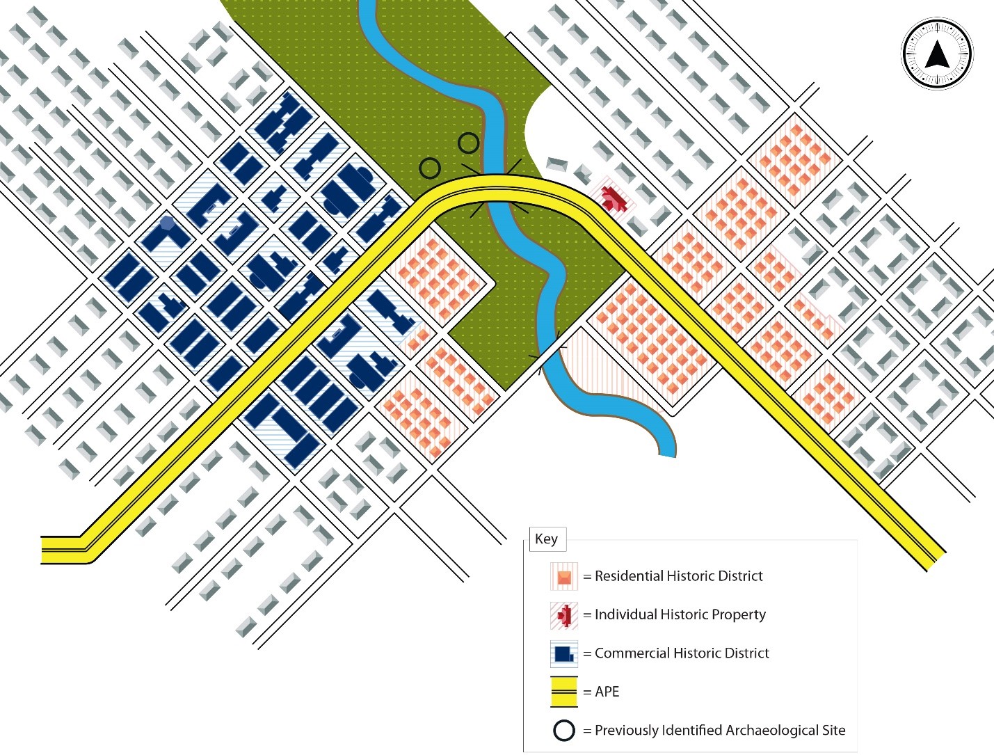
The survey identified two historic districts, an individual historic property, and a previously identified archaeological site within an initial, broader APE that include the first row of buildings on either side of the road. After the design was refined, the APE was narrowed to include only the roadway footprint. The final APE is shown as being limited to the road.
Outcome
Based on its limited scope, this project resulted in an FHWA finding of No Historic Properties Affected and the SHPO concurred with this finding. Any potential impacts of the project were eliminated through consultation and project design, and as a result, there would be no effect to the physical features or associative characteristics that qualify the adjacent historic properties for inclusion in the National Register.

This religious property was the only individual historic property with National Register potential located within the initial APE. Photograph courtesy of Mead & Hunt.
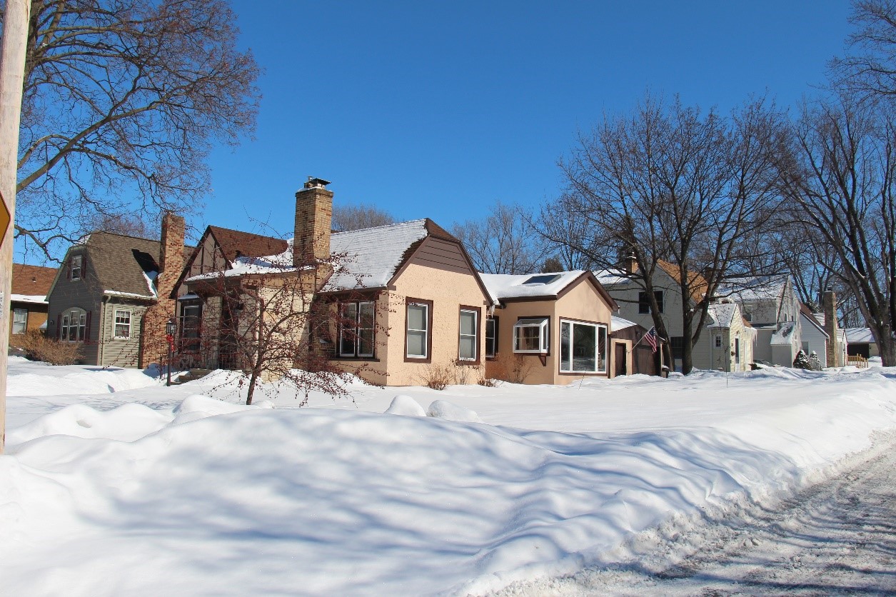
Houses in the first of two residential historic districts identified within the initial APE. Photograph courtesy of Mead & Hunt.
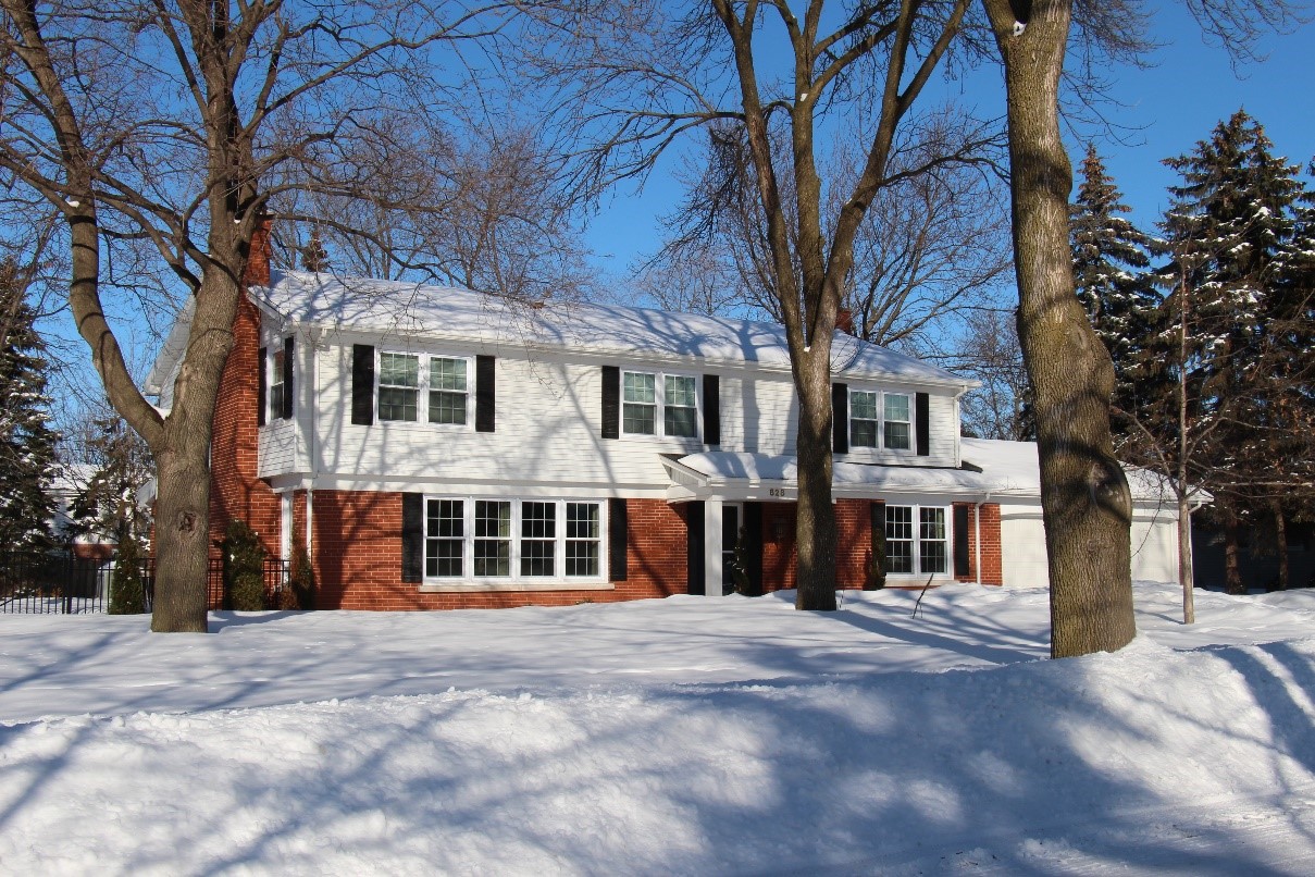
A house in the second residential historic district within the initial APE. Photograph courtesy of Mead & Hunt.
For questions or feedback on this subject matter content, please contact David Clarke.